Tomer’s Take: One more large atmospheric river (AR) surge occurs through 1/17 then the pattern shifts through late January with high pressure ridging.
My forecast video 1/12:
Mammoth Mountain is crystal clear this morning after about 7.5 feet of snow in the last few days. I’m forecasting another 2-3 feet with the next AR surge. They’re reporting 330 inches for the season so far. That’s just behind Alta (370″), Brighton (355″), and Snowbird (351″).


Current Setup
Infrared satellite shows two low pressure systems remaining with Pineapple Express moisture.

Forecast Pattern
Forecast jet stream valid 1/21. The 15-day AR pattern is gone. It’s replaced by an amplified jet stream and building high pressure ridge.

Late January Pattern
Below is the EPS forecast atmospheric pressure anomalies for the middle of the atmosphere valid late 1/26. It shows a high likelihood of high pressure ridging off the West Coast – especially the Gulf of Alaska/British Columbia Coast.

Forecast Timing
Forecast radar/satellite valid 1/12-1/17.
Forecast Totals
Forecast snow totals (inches) valid 1/12-1/14.

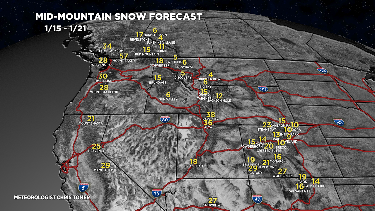
Forecast snow totals (inches) valid 1/15-1/21.

Forecast snow totals (inches) valid 1/12-1/21. 90% of this falls on 1/19-1/20.

Can you add Whiteface to the forecast for the East?