Tomer’s Take: Northeast storm system remains in question. Western ridge starts to weaken with moisture sneaking through on 11/22.
- Intensity and track of potential Northeast storm system remains uncertain with inconsistent data.
- Moisture breaks through Western ridge on 11/22.
- Larger pattern change 11/24-12/1 with trough replacing ridge and higher chances for snow.
Current Setup
Infrared satellite shows the Western ridge and next low pressure that will push moisture through the ridge into the PNW/BC.

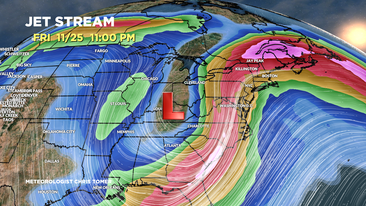
Northeast Storm System?
Forecast jet stream valid 11/25 continues to show a large dip in the jet stream. What happens after this is still in question.

Snowfall forecast contrast: Yesterday (11/20) afternoon versus today (11/21). Talk about inconsistent data. Pull the slider back and forth:


Western Ridge Breaks Down
Forecast jet stream valid 11/29. The high pressure ridge is gone and replaced by a large trough. This would support colder air and widespread snow across CA, UT, CO, WY, ID MT, PNW, BC.

Forecast Timing
Forecast radar/satellite valid 11/21-11/26.
Forecast Snowfall
Forecast snow totals (inches) valid 11/21-11/23.

Forecast snow totals (inches) valid 11/24-11/29.
