Tomer’s Take: The main storm system of the period is 2/13-2/15 with colder air and widespread heavy snow. A 2nd storm system hits on/about 2/18 with contribution from the northern and southern jets.
Current Setup
Infrared satellite shows three different areas of low pressure lined-up. The first low is small and will dive straight south through the Sierra then turn into a southern track low.
The 2nd low is the main low of the period 2/13-2/15.
The 3rd low hits the west after 2/18.

Forecast Pattern
Forecast jet stream valid 2/19. The 2/18 storm system is evident with a big dip in a powerful jet stream. You’ll have a combination of a southern track low + energy spilling south from the northern branch.

Forecast Timing
Forecast radar/satellite valid 2/10-2/15.
Wolf Creek Pass
2/13: 4″
2/14: 12″
2/15: 16″
Taos
2/13: 6″
2/14: 2″
2/15: 14″
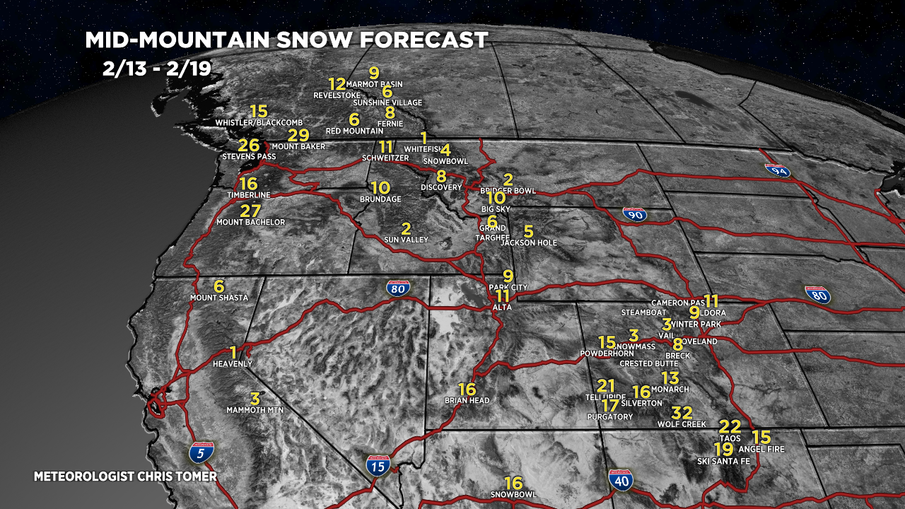
Forecast Totals
Forecast snow totals (inches) valid 2/10-2/12.

Forecast snow totals (inches) valid 2/13-2/19.

Forecast snow totals (inches) valid 2/10-2/19.
Southern Colorado:

Forecast snow totals (inches) valid 2/10-2/19.

Thank you Chris! This helps with coordinating an airport pickup next week
Thanks, Andrew!