Tomer’s Take: Pattern stays active with new snow for PNW/BC/MT/ID/WY/UT/CO/NOCA through 4/21, an additional storm system on/around 4/24, then pattern might transition to a ridge of high pressure late April into early May.
My forecast video 4/14:
Current Setup
Water vapor satellite shows the primary storm track from the Pacific into the PNW.

Forecast Freezing Level
Wasatch, Maximum Height:
4/14: 6600′
4/15: 9400′
4/16: 11500′
4/17: 11500′
4/18: 8400′
4/19: 7700′
Colorado’s Central Mountain Zone, Maximum Height:
4/14: 9900′
4/15: 8200′
4/16: 11700′
4/17: 12600′
4/18: 12100′
4/19: 10500′
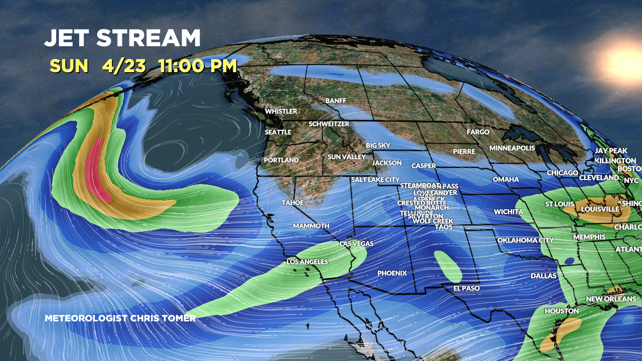
Forecast Pattern
Forecast jet stream valid 4/23. Both jets are still active with one additional storm systems 4/23-4/24.

Late April Pattern
Forecast mid-atmospheric pressure anomalies (GEFS) valid 4/29. The high pressure ridge is unmistakable.

Forecast Timing
Forecast radar/satellite valid 4/14-4/19.
Forecast Totals
4/14-4/16:

4/17-4/23:
