Tomer’s Take: A powerful storm system arrives 12/10-12/13. I’m forecasting a weak to moderate atmospheric river (AR) for the Sierra, colder air, and widespread heavy snow for the PNW, ID, WY, UT, and CO.
- 10″/24hours at Mount Baker.
- 6″/24hours at Wolf Creek. 17″ storm total.
- 5″/24hours at Purgatory. 15″ storm total.
- 4″/24hours at Alta. 154″ season total.
Current Setup
Water vapor satellite shows two storm systems lined-up in the North Pacific. The 2nd storm system approaching the Bering Sea is the powerful storm system slated for the West 12/10-12/13.
Orange/Red = drier air aloft.

Forecast Pattern
Forecast jet stream valid 12/9/2022. Storm #1 hits the West Coast then washes-out as it hits the interior Rockies.
Storm #2 is stronger with better jet support and colder air. It also delivers a weak to moderate atmospheric river (AR) to CA’s Sierra.

Forecast Jet stream valid 12/13/2022. A third storm system is meandering.

Forecast jet stream valid 12/17/2022. Storm #3 drops really far to the south. Most of the West is dry.

Forecast Timing
Forecast radar/satellite valid 12/8-12/13.
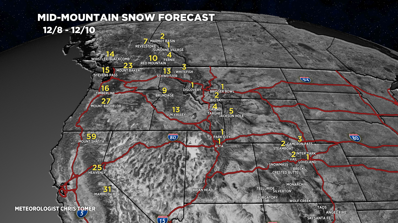
Forecast Totals
Forecast snow totals (inches) valid 12/8-12/10.

Forecast snow totals (inches) valid 12/11-12/13.

Forecast snow totals (inches) valid 12/14-12/17.
