Tomer’s Take: A series of storm systems ride an active jet across the West through 3/27.
My forecast video 3/18:
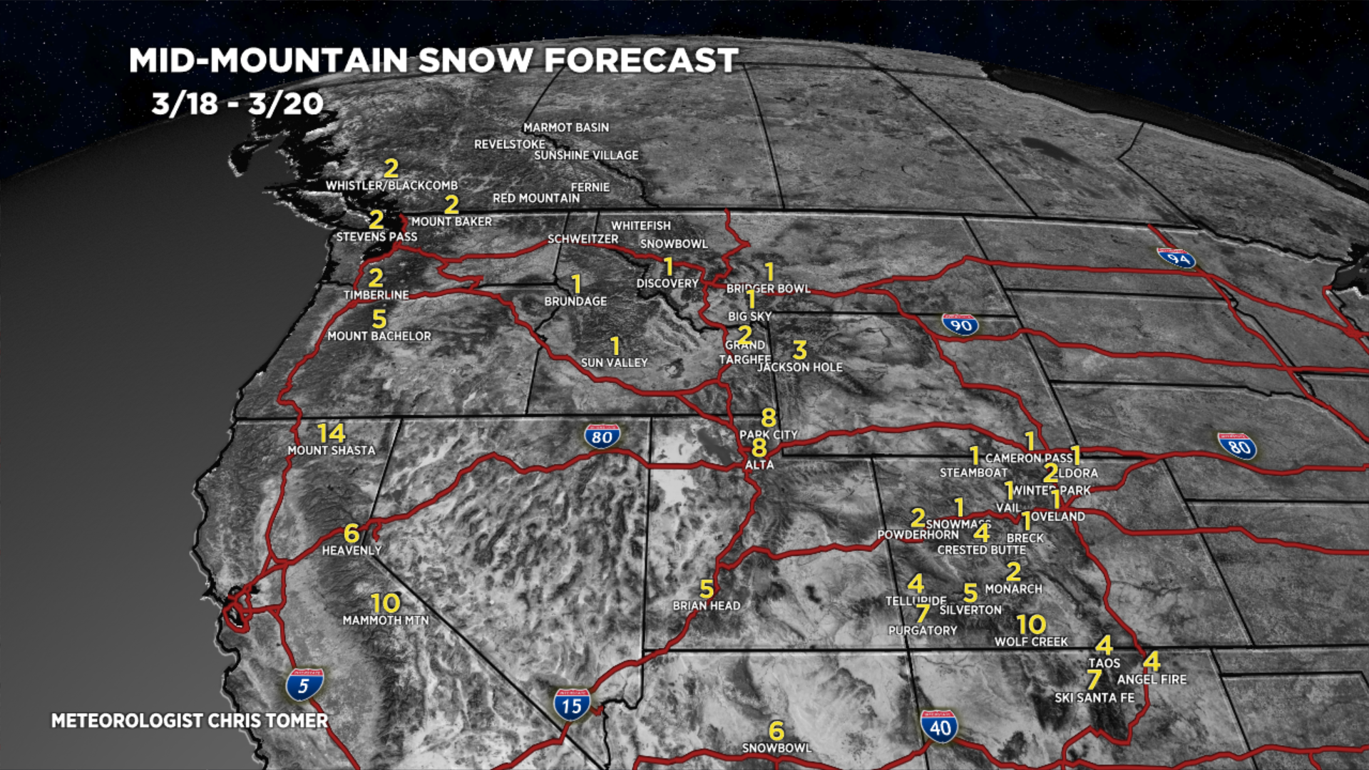
Key Forecast Snow Dates
Sierra: Afternoon 3/19-3/22 with a couple feet of grand total accumulation.
Wasatch: Late 3/19 through 3/25 with 2-3 feet of grand total accumulation.
Teton: 3/20-3/25 with two feet of grand total accumulation.
San Juan Mountains, CO: 3/20-3/23 with 2-3 feet of grand total accumulation.
New Mexico: 3/20-3/22 with 1-2 feet of grand total accumulation.
Forecast Tahoe Rain/Snow Line
3/19: 7900′
3/20: 6700′
3/21: 6700′
3/22: 5600′
3/23: 5700′
Forecast Pattern
Forecast jet stream valid 3/25. Notice the large trough across the West supporting unsettled weather.

Forecast Timing
Forecast radar/satellite valid 3/18-3/23.
Forecast Totals
3/18-3/20:

3/21-3/27:

3/18-3/27:

Hey Chris, big fan. Hoping to plan a last minute trip to Crested Butte, sometime between 3/26 and 3/31. Hoping to plan it around the best chance for snow. Could you show the snow timing for CB during your blog post this week. Thanks and keep up the good work!
Thanks, Brian! I put CB in my blog update today. Here’s what I’m forecasting:
Crested Butte, CO
3/20: 6-8″
3/21: 10-12″
3/22: 6-10″
3/23: 1″
3/24: 2-4″
3/25: 2″
3/26: 2″
3/29: 2″
Chris