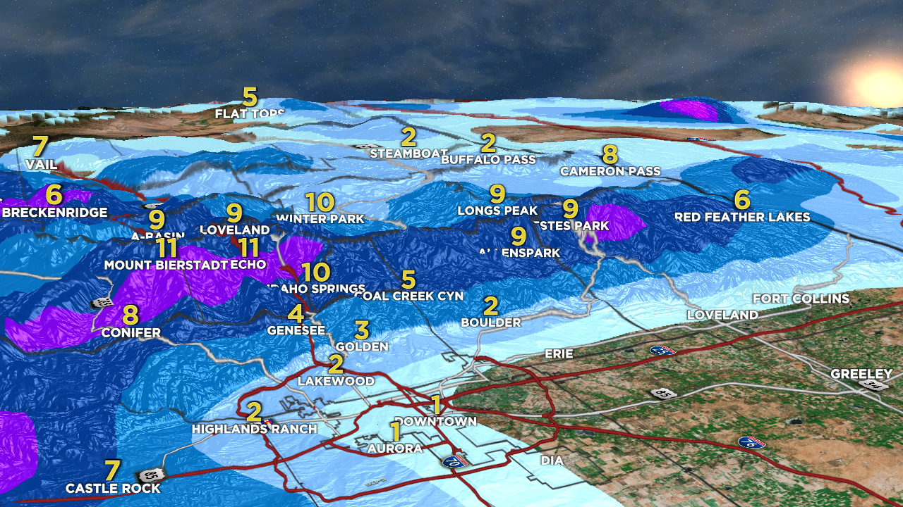
Tomer’s Take: Forecast track of juicy low has shifted south a few miles. That will shift the heaviest snow totals south. Looking at about a foot of snow above 6,000ft for areas Divide-East, Foothills, Palmer Divide, Pikes Peak district, Wet Mountains, South Park, Southern CO.
2nd fast-moving storm system drops north to south on 4/27 into early 4/28.
Alta, UT: 901″
7″ in 24 hours pushes Alta, UT to an unprecedented 901 inch season total. That’s 75 FEET!
Forecast Freezing Level
Wasatch, Daily Max/Min:
4/25: 7400’/5700′
4/26: 10700’/9400′
4/27: 10800’/9200′
4/28: 11800’/8500′
Forecast Timing
Forecast radar/satellite valid 4/25-4/30:
Forecast Totals
Terrain view looking West through Denver to the Foothills and Divide.

4/25-4/27:

4/28-5/3:
2nd Storm System is a fast mover N-S from MT, WY, CO, 4/27-4/28 (mostly 4/27).

Forecast Pattern
Forecast jet stream valid 5/3. Main feature is a meandering low off the CA Coast.
