Tomer’s Take: I’m forecasting three storm systems through 4/29 before high pressure takes control.
My forecast video 4/21:
Wind Forecast
Quandary Peak, CO, Maximum Summit Gust:
4/21: 50mph
4/22: 25mph
4/23: 30mph
4/24: 30mph
Longs Peak, CO, Maximum Summit Gust:
4/21:60mph
4/22: 15mph
4/23: 25mph
4/24: 30mph
Mount Superior, UT, Maximum Summit Gust:
4/21: 35mph, 4-8″
4/22: 25mph, 1-2″
4/23: 15mph
4/24: 20mph, 4-8″
Forecast Freezing Level
Wasatch, Daily Max/Min Levels:
4/21: 7700’/6400′
4/22: 7400’/6400′
4/23: 10200’/8000′
4/24: 10000’/9000′
Colorado’s Central Mountain Zone, Daily Max/Min Levels:
4/21: 7500’/5400′
4/22: 8900’/6600′
4/23: 10900’/8000′
4/24: 10300’/9200′
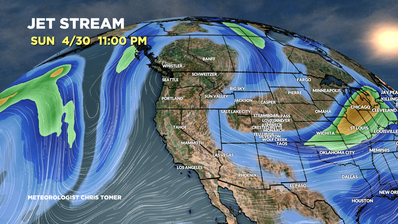
Forecast Pattern
Forecast jet stream pattern 4/30. Notice the dip in the jet over WY, UT, CO, NM 4/28-4/30. The large ridge to the West will move in after this area of low pressure slides East.

Forecast Timing
Forecast radar/satellite valid 4/21-4/26.
Forecast Totals
4/21-4/23:

4/24-4/30:
