Tomer’s Take: A fast-moving storm system will race through Colorado late on 4/27 lingering into early 4/28. Then high pressure builds into the Intermountain West through 5/6.
Forecast Wind Gusts
Quandary Peak, CO:
4/27: 45mph
4/28: 40mph
4/29: 35mph
4/30: 30mph
Mount Bierstadt, CO
4/27: 50mph
4/28: 40mph
4/29: 35mph
4/30: 35mph
Mount Superior, UT:
4/27: 40mph
4/28: 35mph
4/29: 15mph
4/30: 15mph
Grand Teton, WY:
4/27: 50mph
4/28: 25mph
4/29: 20mph
4/30: 20mph
Forecast Freezing Level
Wasatch, Daily Max/Min:
4/27: 10800’/10200′
4/28: 12800’/10700′
4/29: 13500’/12600′
4/30: 13900’/13500′
Colorado’s Central Mountain Zone:
4/27: 11700’/8400′
4/28: 9500’/7000′
4/29: 13000’/10300′
4/30: 13500’/11300′
Forecast Timing
Forecast radar/satellite valid 4/27-5/2:
Forecast Pattern
Forecast jet stream valid 5/6. High pressure over the Intermountain West with an area of low pressure nearly stalled off the CA Coast.

Forecast Totals
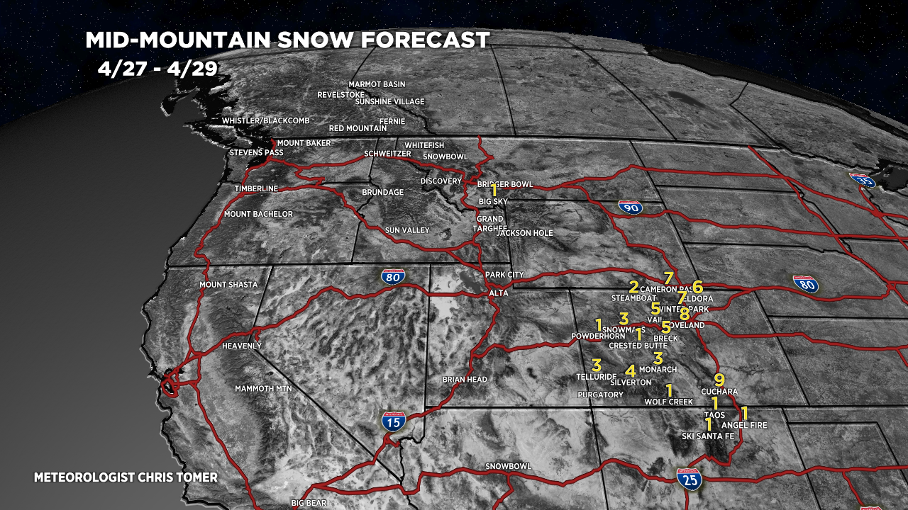
4/27-4/29:

4/30-5/6:
