Tomer’s Take: The Western pattern is changing with the jet moving into a Northwest Flow (NWF) type orientation. Big snow totals are likely through 1/30 in certain preferred NWF locations.
Wolf Creek is reporting 10 inches in the last 24 hours. That’s now 66″ in the last 7 days.
My forecast video 1/21:
Current Setup
Water vapor satellite shows the shifting storm track with most energy now being shuttled into the PNW/BC then diving south on a NW flow.

Forecast Pattern
Forecast jet stream valid 1/30. The NWF runs through 1/30 then lower atmospheric pressures start building in the PNW and expand. This results in an unsettled pattern for the West into early February.

Forecast Timing
Forecast radar/satellite valid 1/21-1/26.
Forecast Totals
Forecast snow totals (inches) valid 1/21-1/23.

Forecast snow totals (inches) valid 1/24-1/30. The power of the NWF is clear. Beneficiaries soak up the NWF and wring it out with high efficiency.

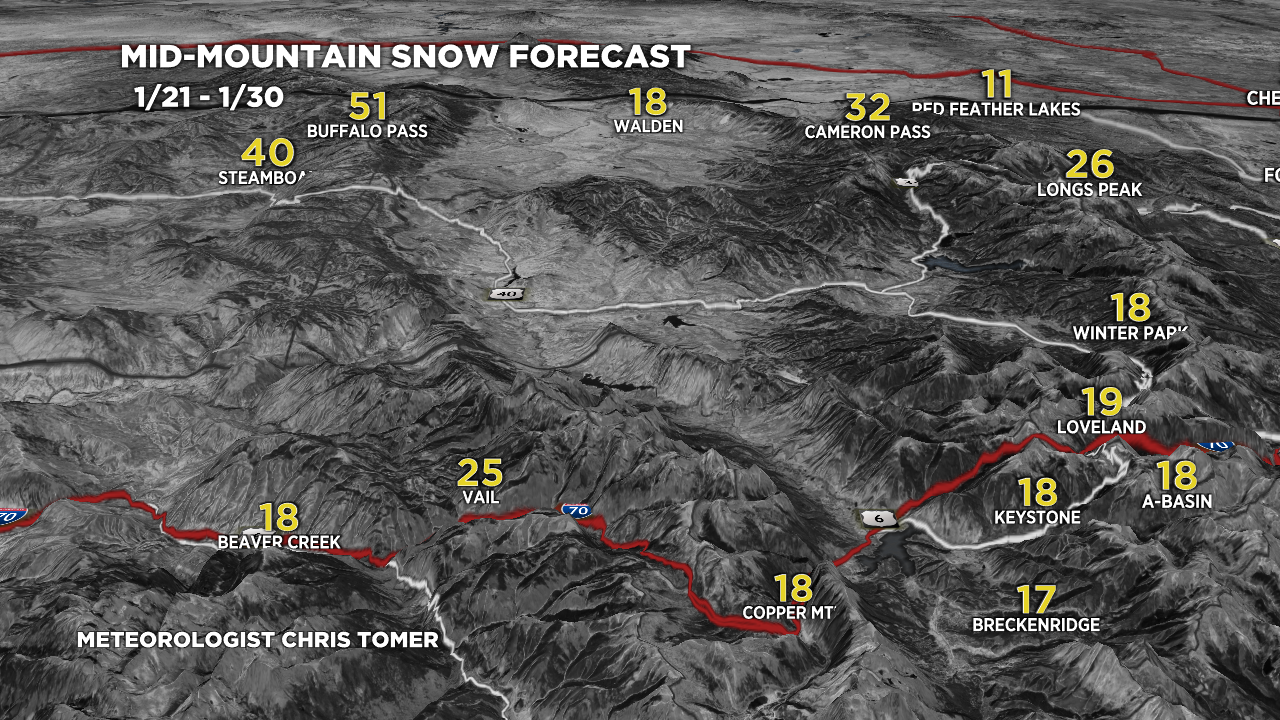
Forecast snow totals (inches) valid 1/21-1/30. Colorado’s Central and Northern Mountain zones.

Forecast snow totals (inches) valid 1/21-1/30.

Chris, dude, can you please send some snow to the interior Canadian Rockies. Please. I’m begging you.
I’ll do what I can, Jason!