Tomer’s Take: A fast Northwest Flow (NWF) continues across the West then the pattern shifts south on/about 1/28 with snow returning to CA.
My forecast video 1/24:
Current Setup
Infrared satellite shows a high pressure ridge off the West Coast and NWF racing through the Northern Rockies.

Forecast Pattern
Forecast jet stream valid 2/2.
Active period 1/27-2/1.
Drier period 2/2-2/4.
Moisture returns on/after 2/4.

Forecast Timing
Forecast radar/satellite valid 1/24-1/29.
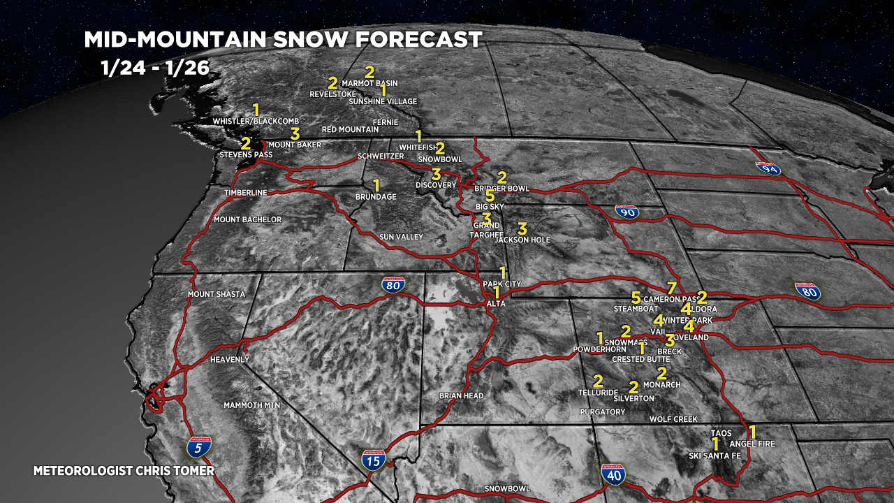
Forecast Totals
Forecast snow totals (inches) valid 1/24-1/26. Light totals with fast Northwest Flow.

Forecast snow totals (inches) valid 1/27-2/2. Bigger totals as entire pattern shifts south.

Forecast C+N CO snow totals (inches) valid 1/24-2/2.
Bulk of accumulation in Steamboat occurs 1/27-1/28 and 1/30-1/31.

Forecast snow plume for Jackson Hole, WY.

Forecast snow totals (inches) valid 1/24-2/2. Bulk of accumulation occurs 1/25-1/26.
2nd Storm System: 1/29-1/30.
3rd Possible Storm System: 2/1-2/2.

Going to be a POW day at Perfect North Slopes tomorrow! (probably at Paoli Peaks too)
Even us mid-westerners get in on the fun without catching a plane every once in a while.
Randall! Let me know how it is today. Chris