Tomer’s Take: One last southern track low is sliding through the Four Corners. Then the jet stream moves north into a NW orientation. A fast NW flow sets up with several fast moving cold fronts/low pressures diving south out of Canada into MT, WY, UT, CO. In Northeast, 2-3 storm systems through 1/29 with 1-3 feet.
My forecast video 1/20:
Current Setup
Water vapor satellite shows the shifting storm track out West.

Forecast Pattern
Forecast jet stream valid 1/29. Notice the fast jet stream running N-S through MT, WY, UT, CO.

Early February
Below is the EPS forecast atmospheric pressure anomalies (mid atmosphere) valid late 2/3. The high pressure ridge retrogrades towards the Bering Sea allowing lower pressures to build across the West.

Forecast Timing
Forecast radar/satellite valid 1/20-1/25.
Forecast Totals
Forecast snow totals (inches) valid 1/20-1/22.

Forecast snow totals (inches) valid 1/23-1/29.

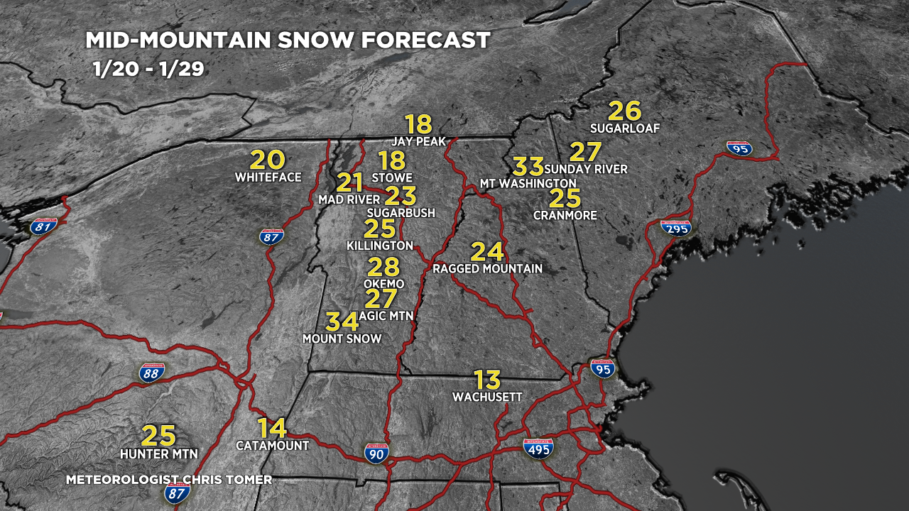
Forecast snow totals (inches) valid 1/20-1/29.
Storm timeline:
1) Today
2) 1/22-1/23
3) 1/25-1/26

I read everyone of these. Thank you for your service Chris
Thanks, Jason!
Thanks Chris for all the great weather info! Love the maps!!
We are so happy to see that you are using your skills in a new and better environment as well.
Thanks, Debra and John! Chris