Tomer’s Take: A fast-moving storm system drops south from Canada through MT, WY, CO, and NM on 4/27. Then high pressure builds in until 5/4 when another storm system arrives.
Forecast Freezing Level
Wasatch, Daily Max/Min:
4/26: 10300’/9400′
4/27: 10800’/9200′
4/28: 12500’/9400′
4/29: 13300’/12600′
Colorado’s Central Mountain Zone, Daily Max/Min:
4/26: 10300’/7000′
4/27: 11300’/7200′
4/28: 10000’/6900′
4/29: 12800’/10300′
Wind Gust Forecast
Quandary Peak, CO:
4/26: 25mph
4/27: 45mph
4/28: 40mph
4/29: 30mph
Torrey’s Peak, CO:
4/26: 25mph
4/27: 50mph
4/28: 40mph
4/29: 30mph
Mount Superior, UT:
4/26: 15mph
4/27: 40mph
4/28: 40mph
4/29: 15mph
Forecast Timing
Forecast radar/satellite valid 4/26-5/1.
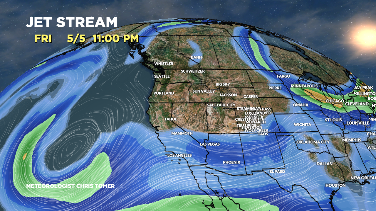
Forecast Pattern
Forecast jet stream valid 5/5. Jet supports and area of low pressure sliding through UT/WY/CO. It looks like a slow mover.

Forecast Totals
4/26-4/28:
Most of this accumulation occurs on 4/27.

4/29-5/5:
Most of this accumulation occurs 5/4-5/6.
