Tomer’s Take:
- A see-saw jet stream setting up East versus West through Thanksgiving (ridge West, trough East).
- Robust high pressure ridge over AK/BC/PNW is problematic through Thanksgiving keeping most of the West drier than normal.
- Out East, a strong storm system possible for Thanksgiving Weekend.
- When will the pattern flip? Possibly on/after 11/27. See below.
Current Setup
Infrared satellite shows the robust ridge over the PNW/BC/AK and ridge amplifiers to its West over the NPAC.
This also creates the see-saw jet pattern with large trough over the East.

Thanksgiving Pattern
High pressure remains strong through 11/24 with jet axis bending far north into Canada. This leaves most of the Rockies drier than normal.

Forecast jet flow valid 11/27. Now this is a different story with a breakdown of the ridge and lower atmospheric pressures plus a strong jet buckling south. This pattern would feed moisture into the PNW and interior Rockies.

East Coast Storm System?
Forecast jet stream valid 11/26 shows a large dip in the jet stream over the East/Northeast and powerful jet streak. Best snow with this setup occurs interior-north through NH, VT, ME. But, this is not set in stone and my feeling is the track and intensity are still a question mark.

Forecast Timing
Forecast radar/satellite valid 11/19-11/24.
Forecast Snowfall
Forecast snow totals (inches) valid 11/19-11/21.

Forecast snow totals (inches) valid 11/22-11/27.

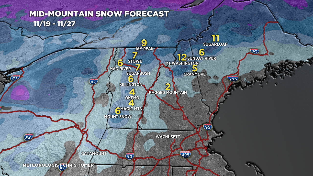
Forecast snow totals (inches) valid 11/19-11/27.

My video forecast 11/19: