Tomer’s Take:
- Current bullseye is PNW, BC, and Banff through 10/31.
- That storm system then drops south into CA and southern tier 11/1-11/6.
- Track and wind field might not be suitable for blockbuster CA snowfall.
- Track has potential to dig too far south.
- Storm system affects ID, UT, AZ, NM, CO, and WY 11/1-11/6. Snow amounts decrease the further south the main storm tracks.
Current Setup
Infrared satellite shows the storm track and large low pressure nailing AK, BC, PNW, and BC. This trough will dislodge the high pressure currently sitting across the West between 11/1-11/6.

11/1-11/6
The forecast jet stream pattern during this period is not optimal for maximum orographics in CA.

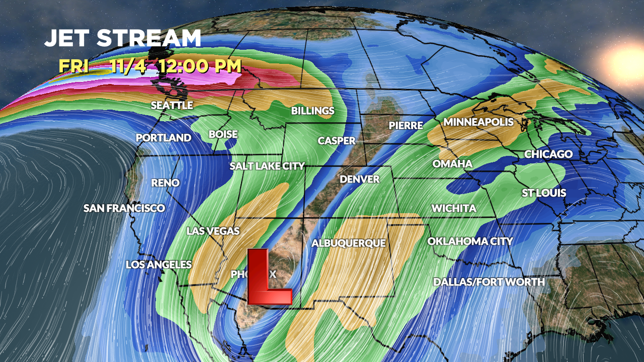
Forecast jet stream valid 11/4. Notice how far south the low tracks. It might cut itself off from the flow by 11/5.

Forecast Timing
Forecast radar/satellite valid 10/29-11/3.
Forecast Snowfall
Forecast snowfall totals (inches) valid 10/29-10/31.

Forecast snowfall totals (inches) valid 11/1-11/6. The further south the low tracks the lower the snowfall totals for the southern tier.

My forecast video 10/29: