Tomer’s Take: The Northwest Flow (NWF) is underway and delivering moderate to heavy snow accumulation. Then two storm systems wrangle the moisture and spread it across the West. They also deliver strong northern and southern jet branches plus colder air. After 2/25 it’s a drier waiting game until the next trough hits the west on/after 2/28 into March 2.
My forecast video 2/19:
Forecast Timing
Forecast radar/satellite valid 2/19-2/24.
Jackson Hole, WY
2/19: 4″
2/20: 6″
2/21: 8″+
2/22: 6″
2/23: 4″
2/24: 4″
2/28: 2″
Alta, UT
2/19: 2″
2/20: 2″
2/21: 14″
2/22: 14″
2/23: 4″
2/24: 4″
Telluride, CO
2/19: 1″
2/20: 0″
2/21: 2″ Late
2/22: 12″
2/23: 3″
2/24: 4″
2/27: 6″
Forecast Totals
2/19-2/21:

2/22-2/28:

2/19-2/28:
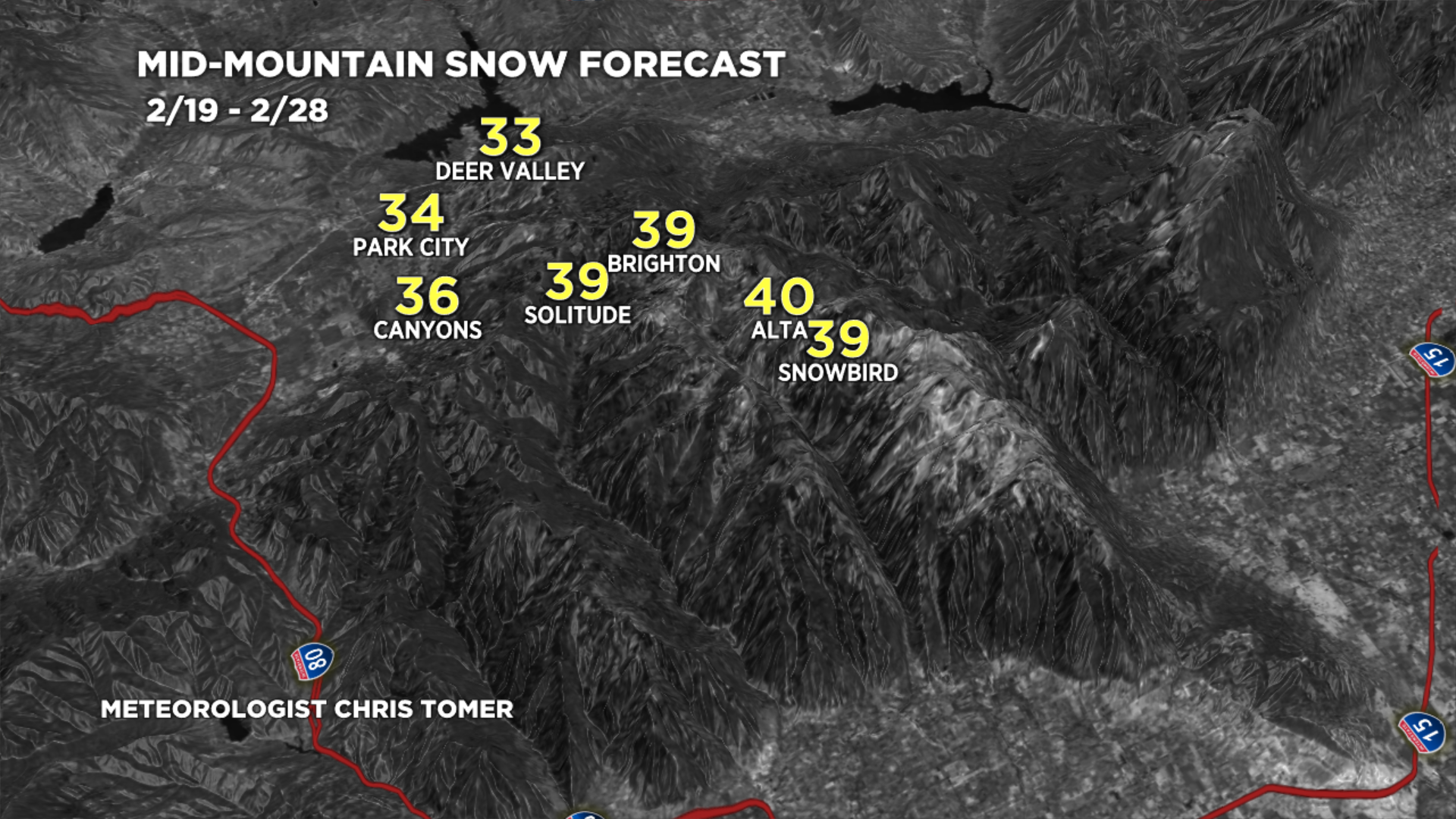
Wasatch Grand Totals.

2/19-2/28:
Central and Northern Mountains of Colorado grand totals.

2/19-2/28:
Southern Mountains of Colorado grand totals.

2/19-2/28:
The bulk of this occurs 2/21, 2/23.
