Tomer’s Take: A wet Spring storm system delivers severe thunderstorms to Colorado on 5/10 then heavy rain and mountain snow through 5/12.
Forecast Freezing Level
Colorado’s Central Mountain Zone, Daily Max/Min:
4/9: 14,400’/12300′
4/10: 13800’/11200′
4/11: 10500’/9000′
4/12: 11000’/9200′
4/13: 12500’/11200′
Forecast Pattern
Forecast jet stream valid 5/10. Notice the dip supporting an area of low pressure tracking through southern UT, AZ, NM, and into Southern CO. This could force the development of an Albuquerque low pressure, which would maximize precipitation in Colorado.

Forecast Timing
Forecast radar/satellite valid 5/8-5/13.
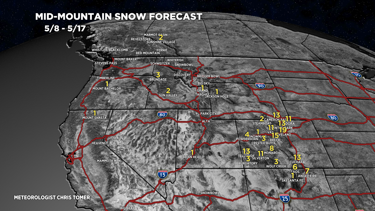
Forecast Totals
5/8-5/17:
These numbers are a worst-case scenario with a perfect Albuquerque low pressure setup.

In Colorado, the rain/snow line may run 9,000′ between 5/10-5/12. This means the heaviest snow occurs above that line.