Tomer’s Take: The next storm system is a powerhouse 12/10-12/13. It has jet support, colder air, and a weak to moderate atmospheric river (AR) contribution.
- A smaller low is currently sliding through the Intermountain West and washing-out.
- An Alberta Clipper races in behind the big storm system on 12/14-12/16 with additional light accumulations in Banff, ID, MT, WY, UT, CO.
Current Setup
Infrared satellite shows a small low washing-out across the Intermountain West followed by the much stronger storm system over the Pacific.

Forecast Pattern
Forecast jet stream valid 12/10/2022.

Forecast jet stream valid 12/12/2022. Impressive jet stream pattern with large trough and ejecting low.

Forecast jet stream valid 12/18/2022. After the big storm system the West turns drier. By 12/18, there are two lows meandering through the Pacific.

Forecast Timing
Forecast radar/satellite valid 12/9-12/14.
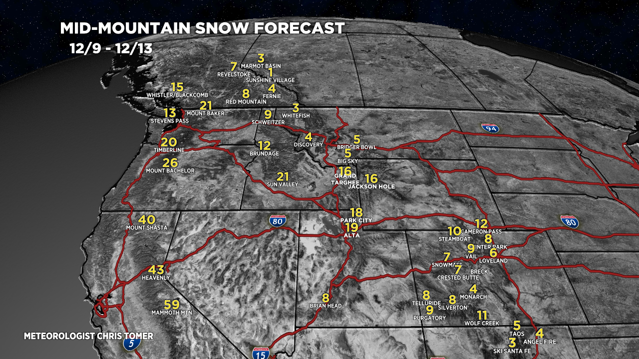
Forecast Totals
Forecast snow totals (inches) valid 12/9-12/13.

Forecast snow totals (inches) valid 12/14-12/18.

My forecast video:
Thanks for doing these, they’re so nice during the ski season. Could you talk a little bit in the next video about what happened with your banff forecast for the 6th to the 9th? You were predicting 1 to 4 inches for sunshine village but they ended up with 20, I’m wondering if there were some interesting orographics that contributed to the discrepancy, maybe there’s a specific pattern I’ll be able to watch out for in the future for these sneaker powder days.
Thanks, Brett! I see the big totals between 12/7-12/9. I’ll look into it. Chris