Tomer’s Take:
- A powerful low pressure and jet stream deliver feet of snow to the West 11/7-11/10.
- Forcing ingredients include a 150mph jet stream/streak, strong orographics, and weak atmospheric river (AR) contribution.
- Peak snowfall times by mountain range are listed below.
Current Setup
Infrared satellite shows the moisture channel, storm track, and low pressure systems lined-up.

Sierra Snowfall
Snow is underway in the Sierra. Peak snowfall:
- Afternoon 11/7 through morning 11/9.
- Widespread 30-40 inches grand totals.
- Rideline wind gusts 60mph+.
Snow is falling at Kirkwood, CA.

Forecast jet stream flow valid 11/8. This is the day of peak snowfall for most of the Sierra.

Forecast Timing
Forecast radar/satellite valid 11/7-11/12.
Forecast Snowfall
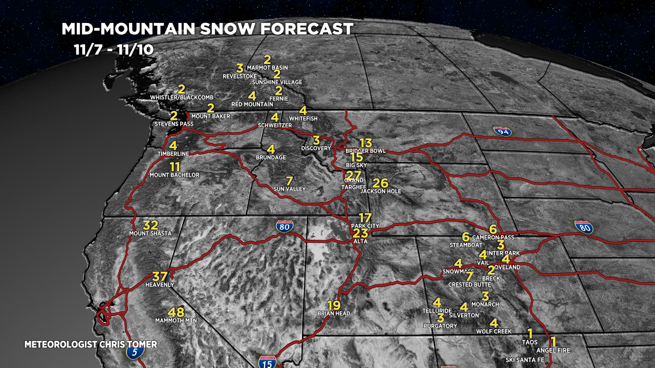
Forecast snow totals (inches) between 11/7-11/10.

Peak Snowfall Times:
- Sierra: PM 11/7 – AM 11/9.
- Tetons: 11/7 – AM 11/10. About 3-4″ each day.
- Wasatch: PM 11/8 – AM 11/10.
- Big Sky: 11/7 – 11/9.
My forecast video 11/7:
Ullr is pleased with you Chris. Please have him visit Summit County again soon!
Thanks, Paul! Chris