Tomer’s Take: Big totals result from an initial northwest flow (NWF) then 1-2 different storm systems dive south through the Rockies with colder air and widespread snow. Looking ahead, the March 1 pattern stays unsettled across the West with lower atmospheric pressure anomalies across the West Coast.
Current Setup
Water vapor satellite shows one low diving south off the CA coast. This low fades. Behind it a large area of low pressure fills the void with a powerful northwest flow via the northern jet branch. This sets the stage 2/19-2/26 for heavy snow across the West.

Forecast Pattern
Forecast jet stream valid 2/26. Waiting on the next trough.

March 1
Forecast atmospheric pressure anomalies valid March 1. Notice the lower pressure anomalies across the West. This would translate into an active pattern.

Forecast Timing
Forecast radar/satellite valid 2/17-2/22.
Jackson Hole, WY
2/18: 2″
2/19: 2″
2/20: 10″
2/21: 18″
2/22: 4″
2/23: 4″
2/24: 4″
2/25: 4″
Alta, UT
2/19: 1″
2/20: 3″
2/21: 18″
2/22: 12″
2/23: 2″
Crested Butte, CO
2/19: 1″
2/20: 2″
2/21: 1″
2/22: 8″
2/23: 4″
2/24: 3″
Forecast Totals
2/17-2/19:

2/20-2/26:

2/17-2/26:
Central + Northern Mountains of Colorado grand totals.

2/17-2/26:
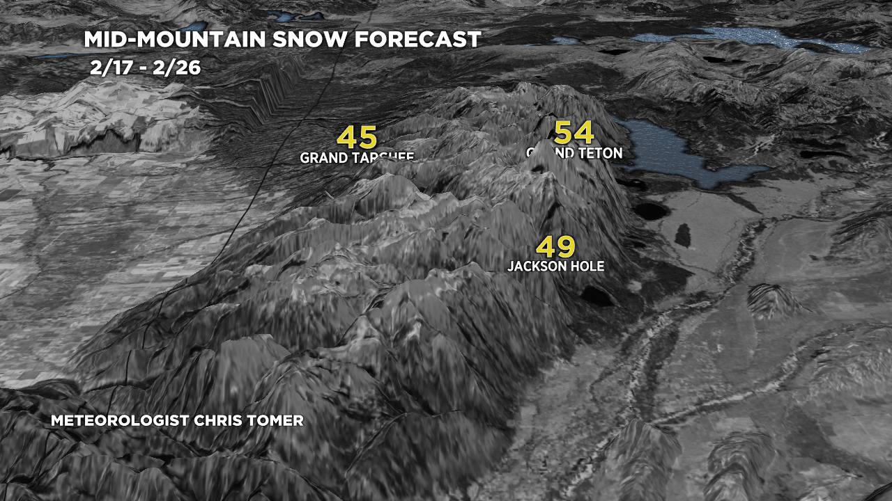
Teton grand totals.

2/17-2/26:
Wasatch grand totals.

2/17-2/26:

Chris, everytime you post,the totals for winter park keep dropping 😒bummer. Was hoping for some big snow for us. Thanks for keeping us updated
Hi Rose, lots of fluctuation…now we’re back to about a foot between now and 3/2.