Tomer’s Take: 2-3 different storm systems are lined-up for the West through 12/6.
- Excellent forcing with orographics, colder air, and subtropical branch involvement.
- CA could see a weak atmospheric river setup.
Current Setup
Visible/Infrared satellite shows a parade of storm systems lined-up including an active southern jet branch.

Pattern Forecast
The first storm system only brushes CA but nails UT, WY, CO with moderate to heavy snow accumulation, wind, and much colder air.

Looking way down the road, the storm track remains active on 12/6. The flow is favorable to PNW, BC, CA, ID, WY, UT, and CO for big totals.

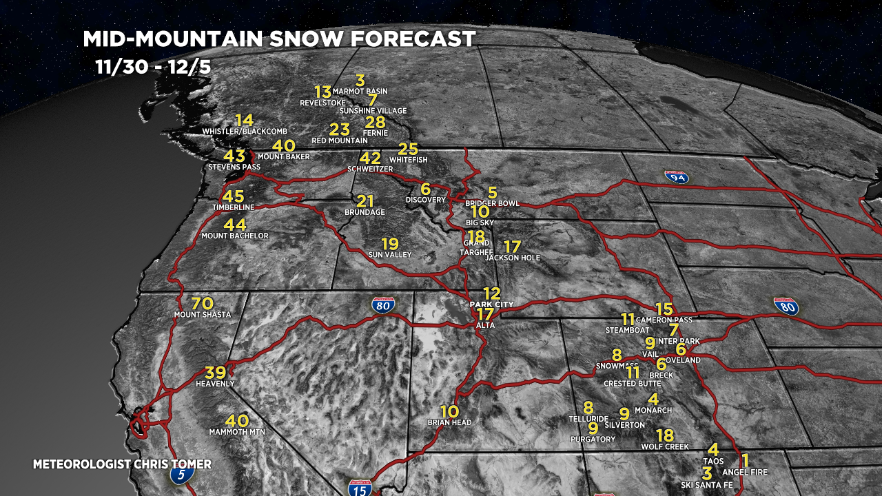
Forecast Snow Totals
Forecast totals (inches) valid 11/27-11/29.

Forecast totals (inches) valid 11/30-12/5.
