Tomer’s Take: Looking ahead, a moderate to strong intensity atmospheric river hits the West Coast on/after 12/27 through 1/1 with 3-4 different waves of rich Pacific moisture. Big totals likely.
Big low in the Northeast continues:
Strong wind, snow, rain, then back to snow for VT, NH, and ME. For example, Killington is reporting strong wind, 7″ of new snow, and 38 degrees.
Current Setup
Infrared satellite shows what’s organizing in the Pacific. I oftentimes refer to this as the Pineapple Express. Snow levels on/after 12/27 will be a concern.

Forecast Pattern
Forecast jet stream valid 12/31. Notice the west to east jet stream. Jet level wind reaches back to Hawaii acting like a conveyor belt for a firehose of moisture.

Forecast Timing
Forecast radar/satellite valid 12/23-12/28.
Forecast Totals
Forecast snow totals (inches) valid 12/23-12/25.

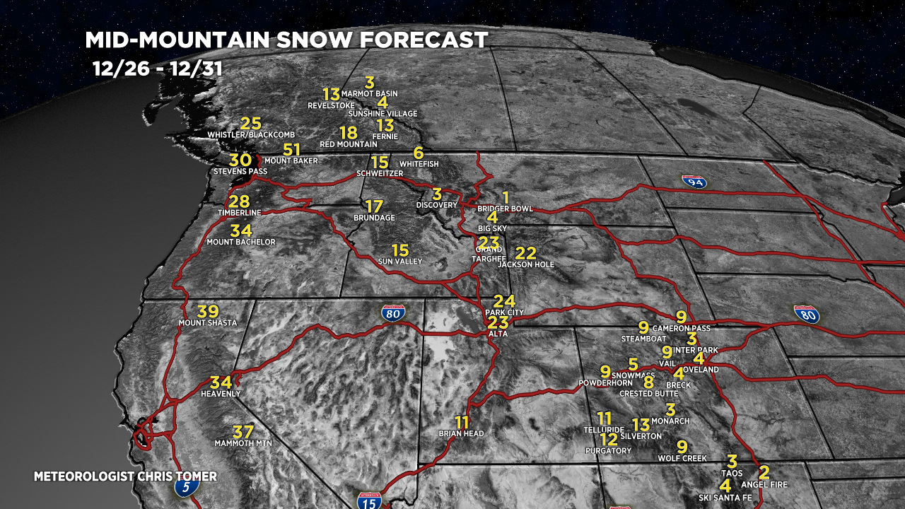
Forecast snow totals (inches) valid 12/26-12/31. This is the heart of the atmospheric river for the West.

Key powder days for the Wasatch:
- 12/27: 6″
- 12/28: 4″
- 12/29: 6″
- 12/30: 6″
- 12/31: 4″+
Forecast snow totals (inches) valid 12/23-12/31.

Awesome Chris…. Looks like I-70 of Colorado gets skunked on this or more accumulation after 12/31 as the waves continue to push through because they are further west?
Hi Chad, things are looking better today. The stronger the AR, the better the totals for CO. Chris