Tomer’s Take: It now looks like the atmospheric river (AR) continues through 1/6 generating feet of grand total snow across the West.
Awesome sunrise view at Palisades Tahoe this morning in-between storm systems.
The first storm system delivered 13-22 inches of snow at higher elevations with a rain/snow problem lower.

My forecast video 12/28:
Current Setup
Infrared satellite shows the Pineapple Express. The initial low pressure systems is tracking through the Intermountain West. All other waves of moisture will follow its lead.

Forecast Pattern
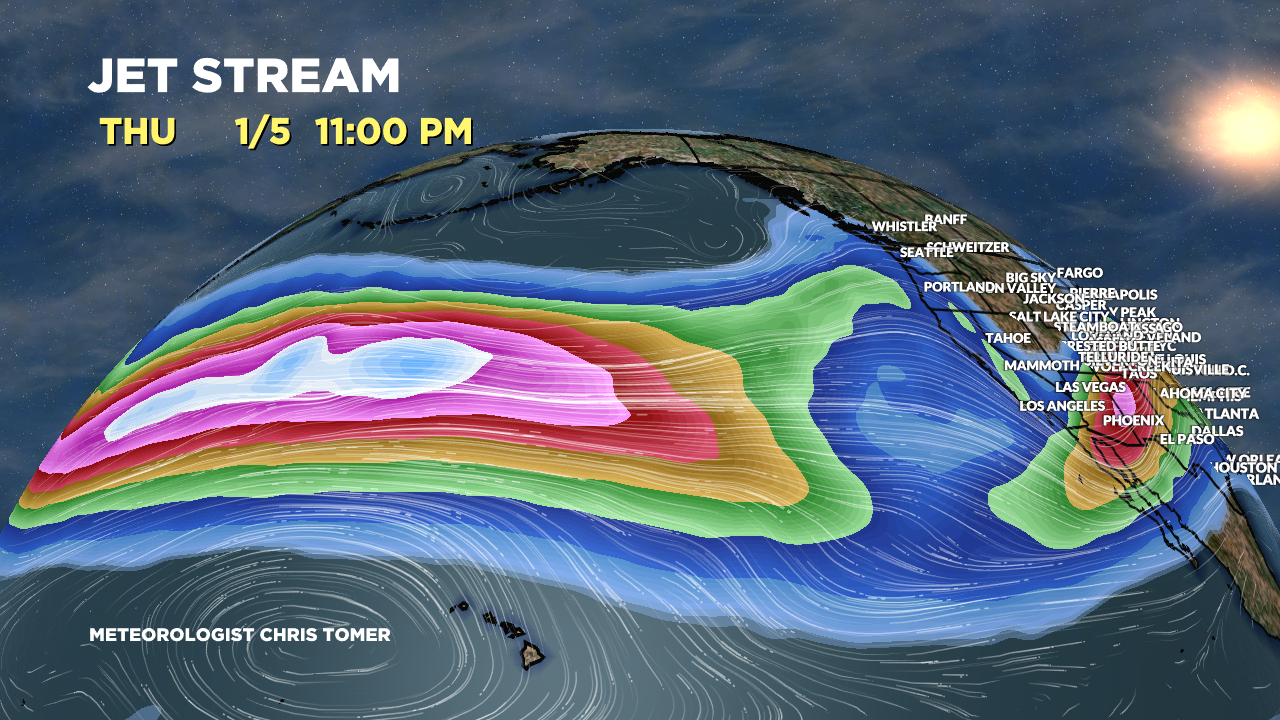
Forecast jet stream valid 1/5 shows the powerful west to east jet stream acting like a conveyor belt for Pacific moisture.

Forecast Timing
Forecast radar/satellite valid 12/28-1/3.
Forecast Totals
Forecast snow totals (inches) valid 12/28-12/30.

Forecast snow totals (inches) valid 12/31-1/6.

My forecast grand totals by 1/6:
Mammoth: 95″
Tahoe/Palisades/Kirkwood: 75″
Alta, UT: 76″
Crested Butte, CO: 56″
Aspen/Snowmass, CO: 35″
Wolf Creek, CO: 53″
Jackson Hole, WY: 34″
Steamboat, CO: 38″
Forecast Snow Timeline for the Wasatch:
- 12/28: 6″
- 12/29: 1″
- 12/30: 12″
- 12/31: 16″
- 1/1: 10″
- 1/2: 0″
- 1/3: 1″
- 1/4: 10″
- 1/5: 14″
- 1/6: 6″
Forecast snow totals (inches) valid 12/29-1/6.

So grateful for your information!! Please come visit CB!!!
I plan on it! Thanks, Krista. Chris
Great news for a drought starved west. Thanks for including Powderhorn/Grand Mesa in your snow totals.
You bet, thanks, Tim!