Tomer’s Take: Active jet pattern continues out West with another atmospheric river (AR) surge coming late 3/13 through early 3/15. This is followed by a storm system on 3/18-3/20. The Northeast could see two storm systems.
My mountain weather forecast video 3/11:
Current Setup
Water vapor satellite shows the Pineapple Express in full swing.

Forecast Lake Tahoe Rain/Snow Level
3/11: Up to 7200′
3/12: Up to 7100′
3/13: Up to 7200′
3/14: Up to 7900′
3/15: Up to 7100′
3/16: Up to 9200′
Forecast Pattern
Forecast jet stream valid 3/19. Notice the active West-to-East flow escorting storm systems inland.

Forecast Timing
Forecast radar/satellite valid 3/11-3/16.
Forecast Totals
3/11-3/13:

3/14-3/20:

3/11-3/20:

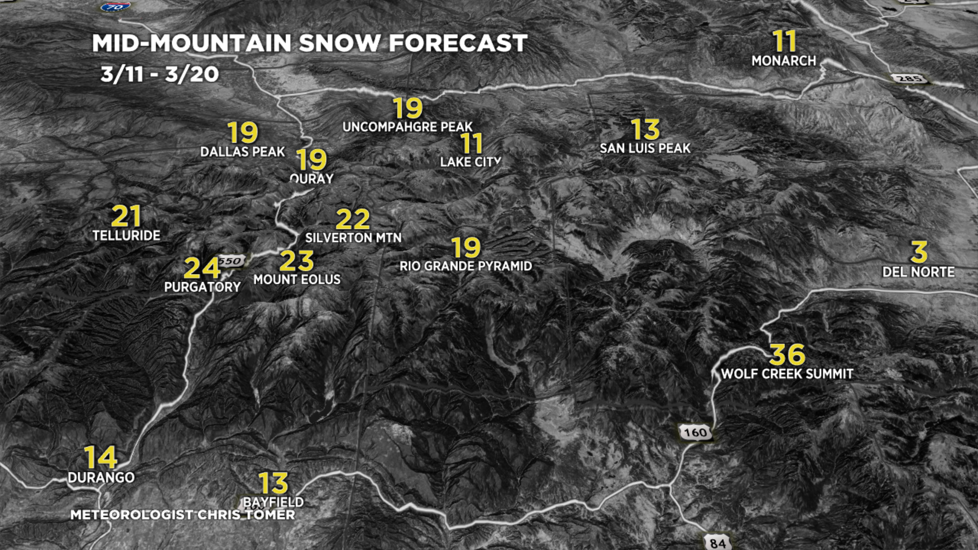
3/11-3/20:

3/11-3/20:
VT/NH/ME Key Snow Dates:
3/11: 1″
3/13: Late 1″
3/14: 10″
3/15: 1″
3/18: 6″
