Tomer’s Take:
- High pressure rebuilds for a few days (10/28-10/31) across the West.
- The next trough digs further south/west 11/1-11/5 and looks to include California.
- This could mean snow, colder temps, and very strong wind across the West.
Current Setup
Visible satellite shows additional low pressure systems lined-up in the north Pacific. They will help build and then potentially cuts-off a trough of low pressure over California on/around 11/3/2022.

11/1-11/5
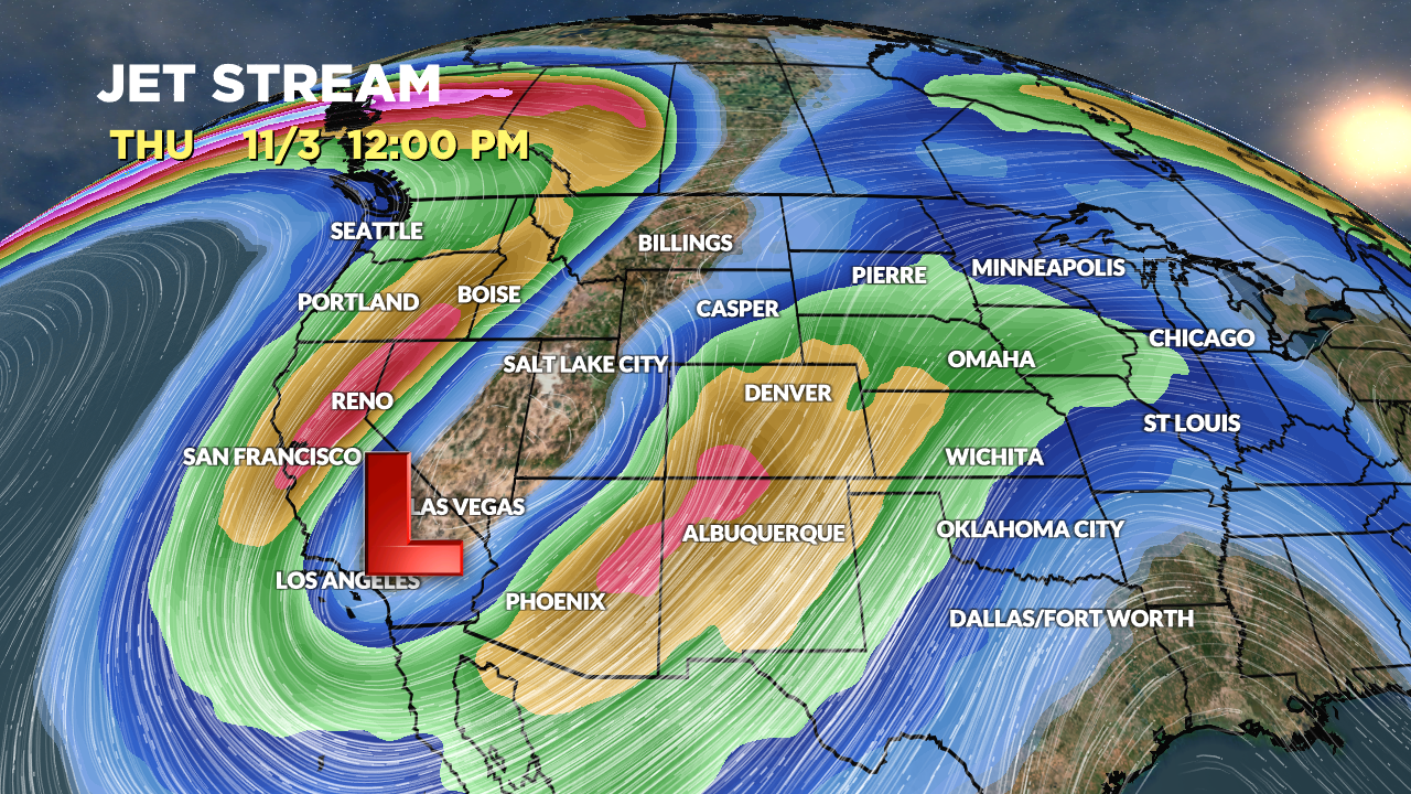
A large trough develops, moves into California, and potentially cuts-off. Below is the forecast mid-atmosphere pressure anomalies valid 11/2-11/3.

Notice the big dip in the jet stream over California on 11/3. This pattern would generate very strong wind in CA, NM, and CO.

Forecast Timing
Forecast radar/satellite valid 10/27-10/31.
Forecast Snowfall
Forecast snow totals (inches) 11/1-11/5.

Bring on the Pow!!
Yes! Thanks, Laura. Chris