Tomer’s Take: I’m forecasting 3-4 additional atmospheric river (AR) surges through 1/16. Sierra snow levels will run abnormally high with the biggest accumulation above 7,000ft.
My forecast video 1/7:
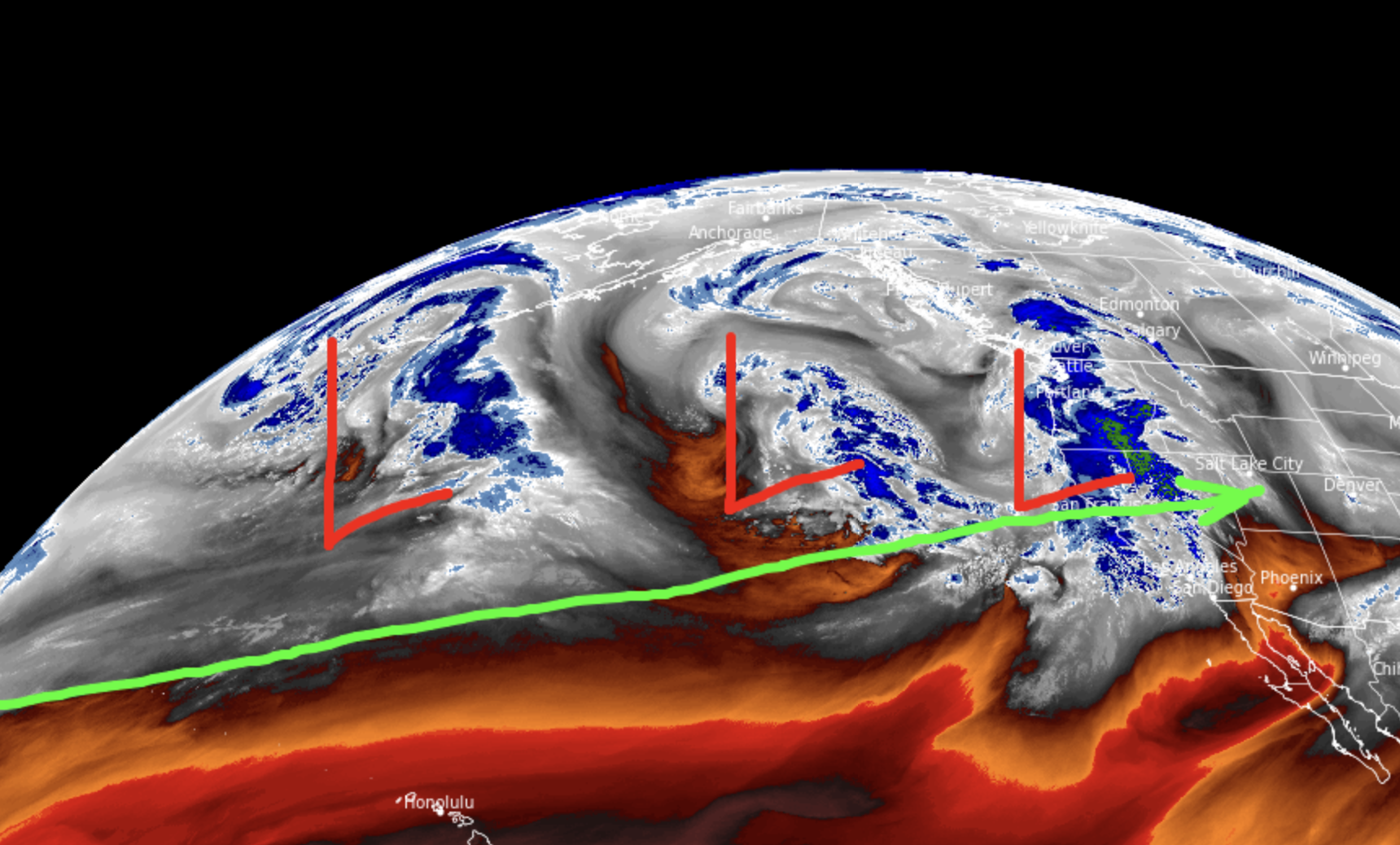
Current Setup
Water vapor satellite shows the Pineapple Express and low pressure systems lined-up through 1/16.

Forecast Pattern
Forecast jet stream valid 1/9. This is a moderate to strong intensity AR surge plus deep trough.

Forecast jet stream valid 1/16. Any additional AR contribution is weak and fading.

Forecast Timing
Forecast radar/satellite valid 1/7-1/12.
Forecast Totals
Forecast snow totals valid 1/7-1/9.

Forecast snow totals valid 1/10-1/16.

Forecast snow totals valid 1/7-1/16.

Hey Chris. I see you have Snowbowl Arizona picking up 14”? Brian Head at 17”. Even more than the Wasatch will get next week. OpenSnow has Snowbowl only getting 4” tho. Are you expecting the storm to move in south enough? I was considering chasing up north but might stay home then if we’re gunna get that much
Hi Brian:
1/9 updated numbers for Arizona Snowbowl->
1/9-1/11: 3″
1/12-1/18: 11″ The bulk of this falls 1/15-1/17.
Brian Head ->
1/9-1/11: 11″
1/12-1/18: 12″ The bulk of this falls 1/15-1/17.