Tomer’s Take: I’m tracking one small southern track storm system and two larger storm systems through 2/22. There are a few bullseye locations.
Timing:
1st Low: Now-2/14, Southern Tier
2nd Low: 2/13-2/15, PNW to Rockies to ABQ Low
3rd Low: 2/19-2/21, PNW to Rockies to ABQ Low
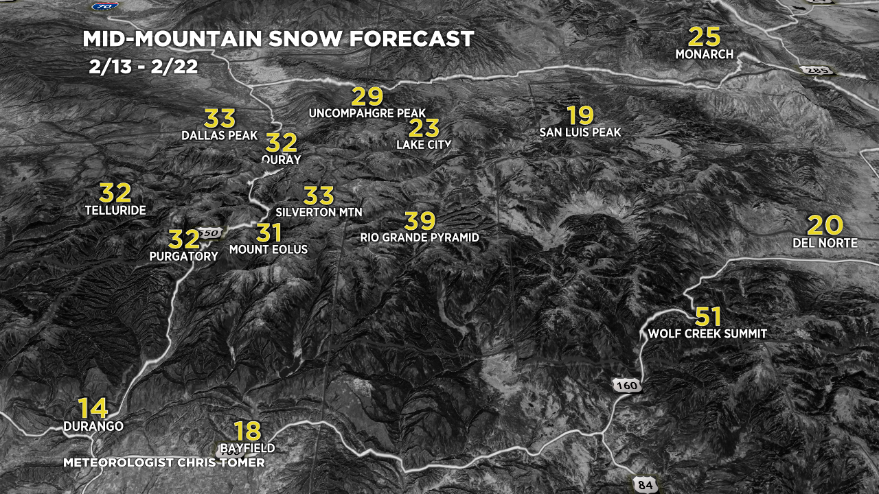
One of my bullseye spots is Wolf Creek, CO where 3-4 feet of grand total snow is possible by 2/22.
It’s a beautiful morning but inbound snow starts around Lunch 2/13.

Current Setup
Infrared satellite shows a smaller area of low pressure slide through the southern tier. Two larger storm systems are lined-up in the Pacific.

Forecast Pattern
Forecast jet stream valid 2/20. The trough is evident with jet support and colder air.

Forecast Timing
Forecast radar/satellite valid 2/13-2/18.
Wolf Creek
2/13: 8″
2/14: 12″
2/15: 17″
2/20: 2″
2/21: 10″
2/22: 2″
Taos
2/13: 4″
2/14: 8″
2/15: 8″
2/20: 3″
2/21: 6″
2/22: 2″
Forecast Totals
2/13-2/15:

2/16-2/22:

2/13-2/22.
Southern CO Grand Totals. These are the result of all three storm systems by 2/22.

2/13-2/22:

I really enjoy your detailed weather forecasts.
The best!
Randy Crumbaugh
Thanks, Randy!
Hi Chris,
I live in ABQ and tonight around 730pm we actually got thundersnow! Being soo rare I think it would be awesome if you could do a special report on it. 2 years ago to the date ABQ reported another thundersnow event. I’m sure there are many local sources you can find documenting the event. I tune into your channel daily as I am a very avid skier who unfortunately lives in the high desert for the time being receiving very little snow fall. Your channel is also one of the most reliable sources for mountain weather patterns when it comes to my job flying helicopters in the mountains of NM and CO. Thank you for what you do!
Thanks, Chris! What a rare occurrence. I’ll have to do something with Thundersnow! Chris