Tomer’s Take:
- There are no big storm cycles on the immediate horizon for the West.
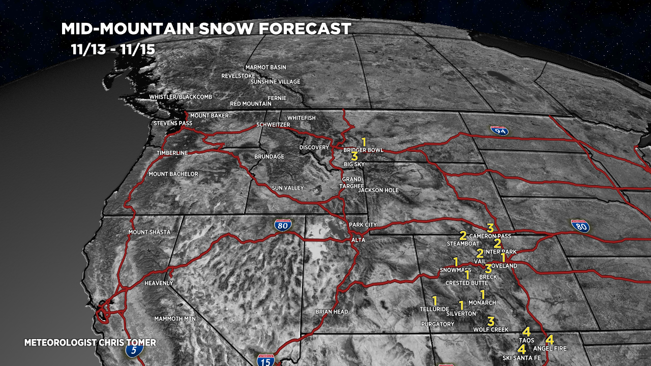
- This week favors the Intermountain West including MT, WY, CO, NM. Total snowfall next 8 days is 10″ or less for all resorts in this grouping.
- Beyond 11/20, the PNW turns more active as high pressure slides east and a trough of low pressure replaces with a powerful jet stream. Details and graphic below.
Southern Track Low
Visible satellite shows the storm track, big high building into the PNW, a cold front racing south from Canada, and a southern track low headed for NM and southern CO.

November 13-22
Forecast jet stream flow valid 11/14.

Forecast jet stream flow valid 11/20. Notice the high pressure ridge sliding east opening the door for the low and powerful jet lurking over the Pacific.

Forecast jet stream flow valid 11/22. Big pattern change here. Powerful jet knifing in with low pressure replacing the high pressure ridge. This would equate to wind, colder temps, and snowfall.

Forecast Timing
Forecast radar/satellite valid 11/13-11/18.
Forecast Snowfall
Forecast snow totals (inches) valid 11/13-11/15.

Forecast snow totals (inches) valid 11/16-11/20.

Thanks for keeping the snow away for a couple weeks. I’m super busy at work so I won’t be missing anything.😂😂🤔