Tomer’s Take:
- Pattern transition underway for the West.
- Currently a weak low is sliding south from the PNW to CA. It’s headed to NM and southern CO as a southern track low through 11/14.
- This low opens the door for a large trough to develop across the Intermountain West (MT, WY, CO) with a stiff northerly flow from Canada through 11/19.
- The PNW/BC/West Coast gets a large ridge of high pressure through 11/19.
- What’s beyond 11/19? Data is mixed but the PNW could turn slightly more active.
- Bottom line: No big storm cycles on the horizon.
Current Setup
Infrared satellite shows the storm track, weak low pressure in the PNW sliding south, a second low headed for AK/Canada, and a high pressure that will become the dominate feature for the PNW/West Coast through 11/19.

November 12-19
Forecast jet stream flow 11/14. Notice the weak low sliding south through CA with light snow accumulation. Behind it a large ridge of high pressure amplifies the jet stream. This in turn sends it south through MT, WY, CO with colder air and fast-moving cold fronts and light snow chances.

Forecast jet stream flow valid 11/17. Big dip in the jet continues for MT, WY, CO.

Forecast jet stream flow valid 11/19. PNW/BC/West Coast high pressure ridge remains strong.

Late November?
Below is one possible pattern valid 11/24/2022. It shows a slight preference for lower mid-atmosphere pressures in the PNW/BC. Higher pressures are possible for parts of the Intermountain West.
This would mean most of the snow/colder temps are in the PNW/BC.

Forecast Timing
Forecast radar/satellite valid 11/12-11/17.
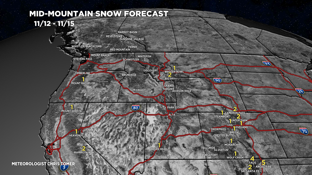
Forecast Snowfall
Forecast snow totals (inches) valid 11/12-11/15.

Forecast snow totals (inches) valid 11/16-11/19.

My forecast video 11/12:
Thanks!!
It sure would be nice (and pretty) to have a light dusting for Thanksgiving
Hi Brian! It looks like the Mountains might get snow on Thanksgiving. Denver might be around 50 degrees.
Chris