Tomer’s Take:
- First of two low pressure systems now moving south through the PNW into MT, ID, WY, UT and eventually CO between 10/22-10/24.
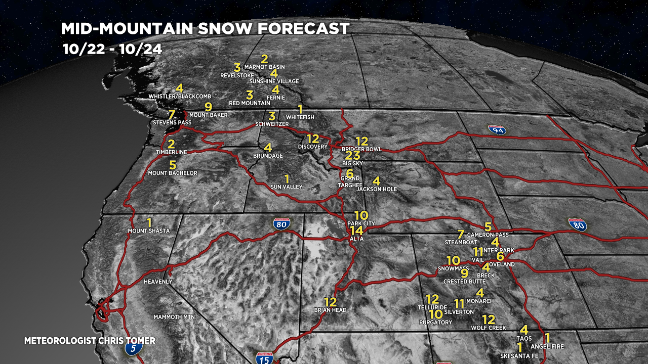
- Bullseyes: Big and Little Cottonwood Canyons, Brian Head, Big Sky, Bridger Bowl, Discovery, Western and SW Colorado mountain zones.
- Strong 40-100mph wind gusts 10/22-10/24 across the higher peaks.
- 2nd low pressure system 10/26-10/28.
Current Setup
Infrared satellite shows storm #1 diving south across the West. Storm #2 is about to be recaptured by the Polar Jet stream and arrives across the West 10/26-10/28.

Forecast Wind Gusts
The jet stream delivers strong wind gusts above treeline on Sunday 10/23.

Kings Peak, UT:
| Kings Peak | MPH |
| 10/22 | 65 |
| 10/23 | 35 |
| 10/24 | 35 |
| 10/25 | 40 |
Forecast Snow
Forecast radar/satellite valid 6am Sunday 10/23/2022.

Forecast radar/satellite valid 6pm Sunday 10/23/2022.

Forecast snow totals (inches) between 10/22-10/24.

Forecast snow totals (inches) between 10/26-10/28.

My forecast video: