Tomer’s Take: Avalanche warnings are in effect for the Wasatch Front. Freezing levels rise rapidly next 48 hours.
The storm track favors the PNW/BC/Northern Tier through 4/12. This storm systems breaks loose on/after 4/13 and runs through UT, WY, CO.
Forecast Freezing Levels
Wasatch:
4/10: 13300′ <–24/7 above freezing
4/11: 13100′ <– 24/7 above freezing
4/12: 12000′
4/13: 6700′
Colorado’s Central Mountain Zone:
4/10: 13800′
4/11: 14400′
4/12: 13700′
4/13: 12300′
4/14: 9500′
Tetons:
4/10: 12500′
4/11: 12300′
4/12: 9200′
4/13: 5300′
Forecast Max Temps 4/11
SLC/Wasatch:
Notice the widespread 50-degree high temps across the entire Wasatch Range.

Forecast Pattern
Forecast jet stream valid 4/19. Spring pattern with low velocity and a low pressure sitting off the CA coast.

Forecast Totals
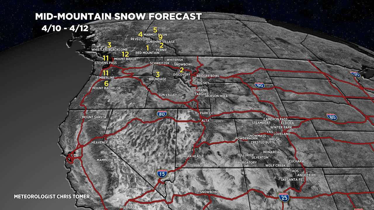
4/10-4/12:

4/13-4/19:
