Tomer’s Take: The track has shifted slightly north and the rain/snow line is trending higher: 10,000ft. This will decrease overall totals, but they’ll still be significant.
Forecast Freezing Level
Colorado’s Central Mountain Zone, Daily Max/Min:
5/9: 14100’/11700′
5/10: 14000’/10800′
5/11: 11200’/10000′
5/12: 12500/10200′
5/13: 11200’/10300′
Forecast Pattern
Forecast jet stream valid 5/10. Deep May trough supporting an area of low pressure. Strong jet wind/sheer for the Eastern Plains of CO and severe thunderstorm potential.

SPC convective outlook valid 5/10:
Yellow = Slight Risk for Severe Thunderstorms

Severe Weather Climatology for Colorado from the Colorado Climate Center and State Climatologist Dr. Russ Schumacher:

Forecast Timing
Forecast radar/satellite valid 5/9-5/14.
Heavy rain is possible in Denver and across the Front Range below 10,000feet on Thursday.
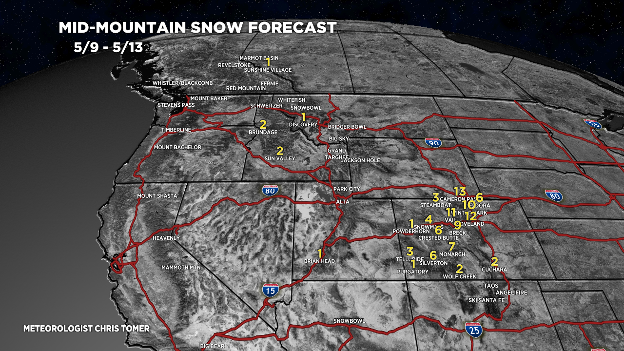
Forecast Totals
5/9-5/13:
Overall snow totals have decreased versus forecast numbers from 5/8.
