Tomer’s Take: A two-storm combo delivers feet of snow to many Western mountain zones through 12/7.
- A weak atmospheric river (AR) remains in my forecast for CA ‘s Sierra between 12/1-12/2.
- Storm #2 delivers a very weak AR on 12/3-12/4.
- Both storm systems drop heavy snow accumulation across the interior Rockies.
Current Setup
Infrared satellite shows storm #2 and storm #3 lined-up. The southern jet branch also gets involved in the AR.

Forecast Pattern through 12/7
Storm #1 hits the Sierra hard with a powerful N+S jet combo and weak atmospheric river (AR).
Forecast jet stream valid 12/1.

Forecast jet stream valid 12/7.

Forecast Timing
Forecast radar and satellite valid 11/30-12/5.
Forecast Totals
Storm #1 + Storm #2 grand total snow.
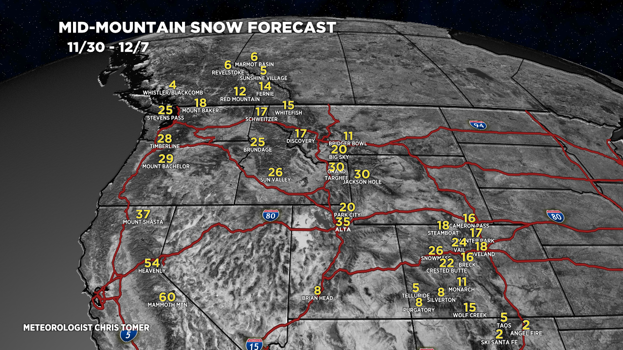
Forecast snow totals (inches) valid 11/30-12/7.
My forecast numbers for the Sierra might be a touch high but let’s see how much moisture gets blown in with this AR.

My forecast video 11/30:
Oh happy day!
So much excitement! Thanks Chris!
yay. some good skiing ahead!