Tomer’s Take:
- Mega High breaks down 9/9.
- Wildfire smoke circulating.
- Tropical remnants fill the void 9/13-9/17.
- Light mountain snow possible.
- Run Rabbit Run forecast below.
Current Setup
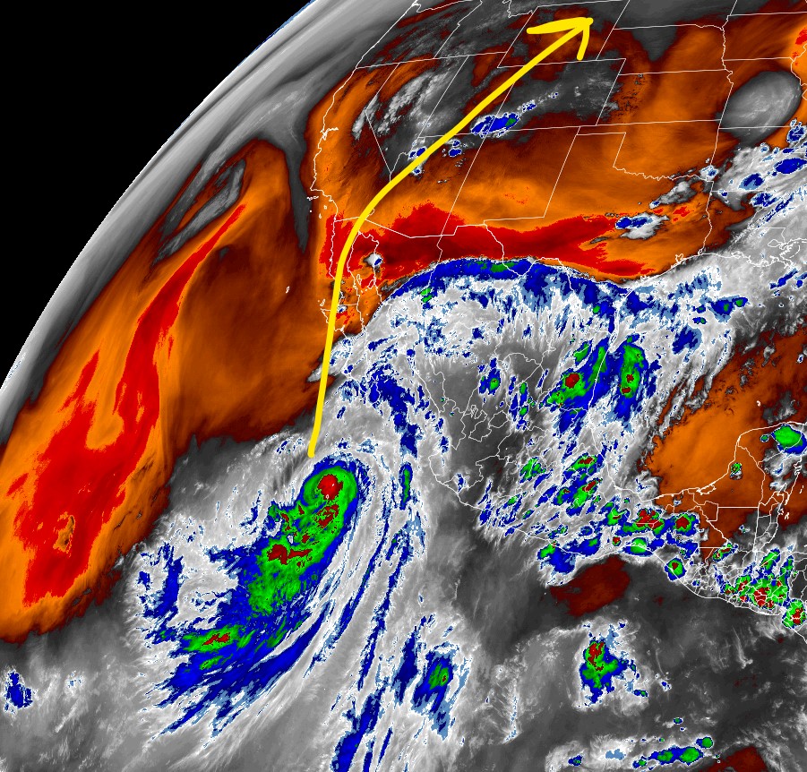
You can see where the tropical remnants will come from in on this water vapor satellite image.

Wildfire Smoke
Smoke is circulating from wildfires in ID, OR, and CA.
Look at the thick smoke over the Tetons on 9/6. Photo taken by Pilot Chad Andrews (@crjcaptchad):

Forecast image below valid Noon 9/7.

6pm 9/7:

Will the wildfire smoke stay in Colorado this weekend? Yes.
Tropical Remnants
After the Mega High breaks down what fills the void? Remnants from a tropical system. Forecast image below valid 9/15.

Impacts in UT, WY, CO:
- Valley rain showers 9/13-9/17.
- Light snow on the highest peaks.
- Air temps drop.
- Gusty wind above treeline 20-50mph.
Run Rabbit Run 9/16-9/17
The trail run takes place in/around Steamboat Springs, CO.
| Day | Precip % |
| 9/15 | PM 60% |
| 9/16 | PM 50% |
| 9/17 | PM 40% |
| 9/18 | PM 30% |
Mid-atmosphere relative humidity shows the moisture across the northern half of Colorado on 9/16-9/17.

Will the storms forecast for the afternoons of RRR most likely contain lightning?
Hi Dan, at this point no. Friday appears to have the higher chance for afternoon rain showers with plenty of sunshine early in the day. Breezy both Friday and Saturday afternoon at higher elevations. Chris