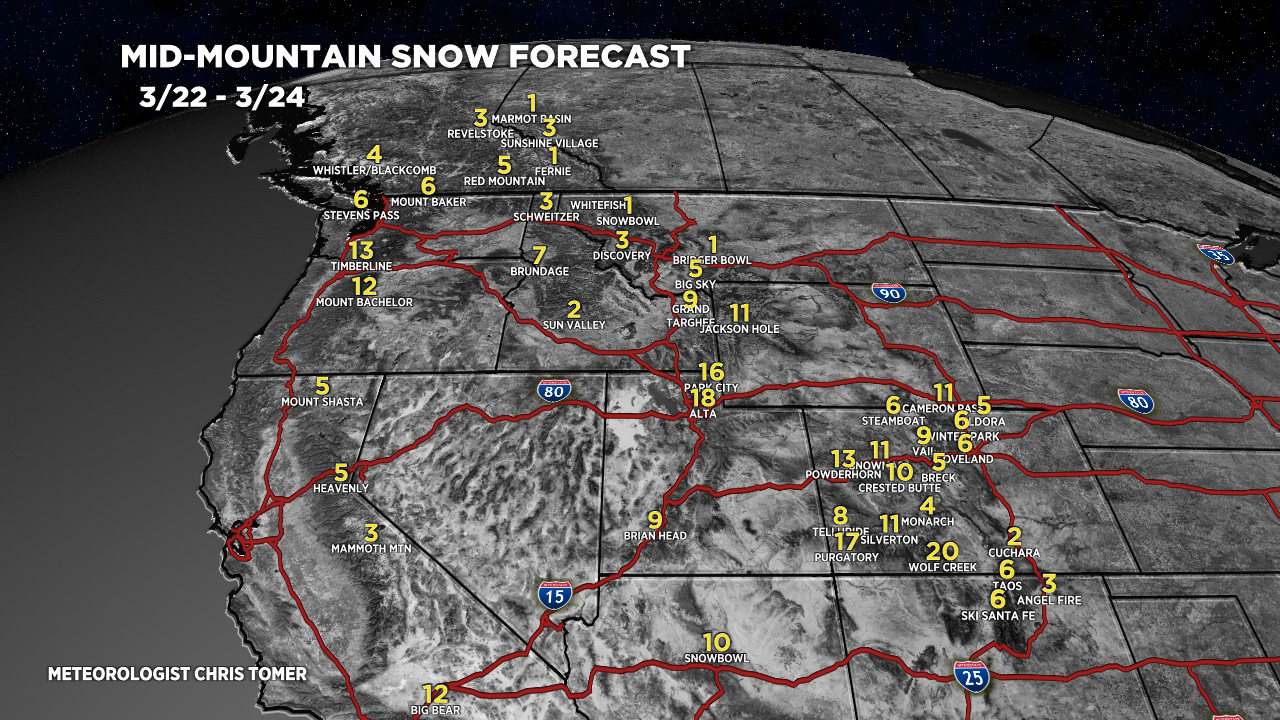
Tomer’s Take: Active storm track through 3/31 with three storm systems and feet of grand total accumulation in CA, UT, WY, CO, MT.
Big Bear Mountain Resort in Southern CA is reporting 24 inches in 24 hours.
Alta is reporting another 8 inches overnight. They’ve officially cracked 700 inches! Now at 704″ for the season so far.
Mammoth Mountain is reporting 836 inches at the summit so far this season. They’re just a few inches away from breaking their all-time season record at the Base.
Current Setup
Water vapor satellite shows all three storm systems lined-up through 3/31.

Forecast Pattern
Forecast jet stream valid 3/31. Notice the area of low pressure sliding through the Southern Rockies.

Forecast Timing
Forecast radar/satellite valid 3/22-3/27.
Crested Butte, CO
3/22: 8″
3/23: 2″
3/24: 2″
3/25: 1″
3/26: 1″
3/29: 1″
3/30: 5″
3/31: 2″
Forecast Totals
3/22-3/24:

3/25-3/31:

3/23-3/31:
NH/VT/ME Key Snow Dates: 3/25-3/26. (Rain on 3/23).


Hi Chris,
Can you do a post sometime making sure people know global warming/climate change is real? Some people recently in comments seem to think that because of all the snow the west is getting this winter and a colder than average winter means that climate change is not real.
Love you posts!
Thank you!
-Jay Carroll
Jay, there are just going to be people who won’t understand what is happening. Even if it is not caused by us, because it has been politicized and denial is a powerful tool. We have a trip planned to Jackson/yellowstone area in early to mid June and I think there will be bad flooding again. Why?? Because when 600 inches of snow melt too fast (because of higher temps) with rain on top, you get more volume than roads and bridges were built to accommodate.
Chris, keep doing what you do best forecasting the weather at our favorite ski resorts.
You’re the best!