Tomer’s Take: Three storm systems are likely across the West through 3/23. The last significant AR surge continues today then fades. In the Northeast, heavy snow continues today with another strong storm system possible 3/22-3/23.
Forecast Tahoe Rain/Snow Line
3/14: Up to 7900′
3/15: Up to 6600′
Current Setup
Water vapor satellite shows the Pineapple Express entrenched. Red/orange = drier air aloft.

Forecast Pattern
Forecast jet stream valid 3/21. This is the 3rd storm system of the period.

Forecast Timing
Forecast radar/satellite valid 3/14-3/19.
Alta, UT
3/14: Late 5″
3/15: 10″
3/18: 1″
3/21: 20″
3/22: 3″
Forecast Totals
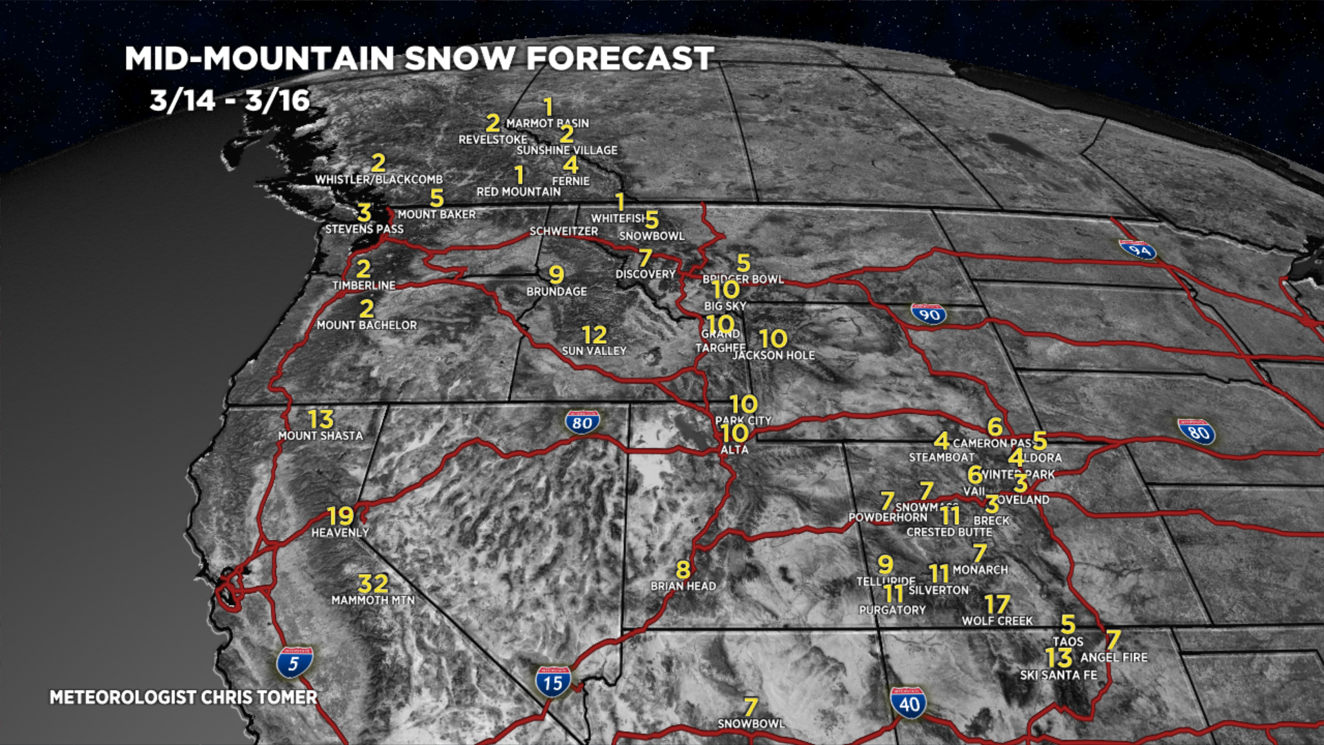
3/14-3/16:

3/17-3/23:

3/14-3/23:
VT/NH/ME Key Snow Dates:
3/14: 11-12″+
3/15: AM 2″
3/17: 2″
3/22: 8″
3/23: 6″
