Tomer’s Take: Three storm systems are lined-up through 2/16. The initial trajectory is the PNW/BC for biggest overall totals. The third storm system on/after 2/14 appears to be the most robust.
Current Setup
Infrared satellite shows three storm systems lined-up in the Pacific with initial trajectories into the PNW/BC.

Forecast Pattern
Forecast jet stream valid 2/16. An active pattern with a large dip in the northern branch and some contribution from the southern branch. This supports a storm system 2/14-2/16.

Forecast Timing
Forecast radar/satellite valid 2/7-2/12.
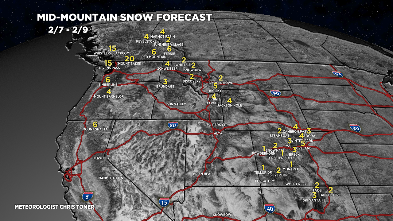
Forecast Totals
Forecast snow totals (inches) valid 2/7-2/9.

Forecast snow totals (inches) valid 2/10-2/16.
UT: The best snow chance is 2/14-2/15.
CA: The best snow chances are 2/11 and 2/14.

Forecast snow totals (inches) valid 2/7-2/16.
The key days for snow are 2/8-2/9 and 2/15.

Forecast snow totals (inches) valid 2/7-2/16.
The key days for snow are 2/7, light 2/9-2/11, and 2/12-2/13.

Forecast snow totals (inches) valid 2/7-2/16.

Hey…welcome back. See your new show is doing well. Hope you’re getting after it!
Thanks so much, CW!