Tomer’s Take:
- Three different storm systems are lined-up between 11/2-11/10.
- Storm #1 is currently sliding south through CA and will take a southern track benefitting the southern tier of the Rockies.
- Storm #2 takes a more central/north track favoring the Central and Northern Rockies.
- Storm #3 is similar to storm #2. Big snow totals are possible with both because of more favorable orographics and track.
Current Setup
Snow is falling across the Sierra with storm #1.
Below is the Red Cliffs cam at Kirkwood.

Below is the Alpine Peak cam at Palisades Tahoe.

Infrared/visible satellite shows the storm track and three different low pressure systems riding the flow.

November 2-10
Forecast jet stream flow valid 11/4/2022.

Forecast jet stream flow valid 11/5/2022. The orientation of the jet is more favorable for orographics. In fact, this is technically a moderate-strong Atmospheric River (AR) setup for the PNW/BC. Some of that moisture gets thrown into the interior Rockies generating big snow totals.

Forecast jet stream flow valid 11/6/2022.

Forecast jet stream flow valid 11/7/2022.

Atmospheric River (AR)
A brief moderate-strong AR occurs late 11/3-11/5. This produces copious amounts of liquid/snow for the PNW/BC. Below is forecast Integrated Water Vapor Transport (IVT).

Forecast Timing
Forecast radar/satellite valid 11/2-11/7.
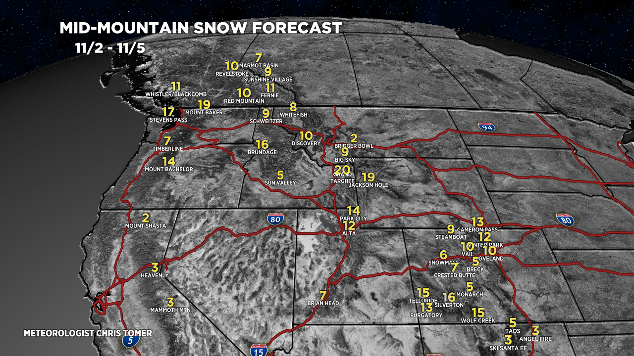
Forecast Snowfall
Forecast snow totals (inches) valid 11/2-11/5.

Forecast snow totals (inches) valid 11/6-11/10.

My forecast video 11/2: