Tomer’s Take: Three different storm systems are lined-up through Valentine’s Day. The bullseye continues to be the PNW/BC.
Jackson Hole, WY is reporting 10″ in the last 24 hours. I’m forecasting light additional snow today then 3-9″ on on 2/8.
Current Setup
Water vapor satellite shows two areas of low pressure lined-up over the Pacific.

Forecast Pattern
Forecast jet stream valid 2/15. A large trough and area of low pressure slides across the West.

Forecast Timing
Forecast radar/satellite valid 2/6-2/11.
Mount Baker
Forecast timing:
2/6: 10″
2/7: 15″
2/8: 0″
2/9: 1″
2/10: 11″
2/11: 1″
2/12: 6″
2/13: 12″
2/14: 2″
Forecast Totals
Forecast snow totals (inches) valid 2/6-2/8.

Forecast snow totals (inches) valid 2/9-2/15.

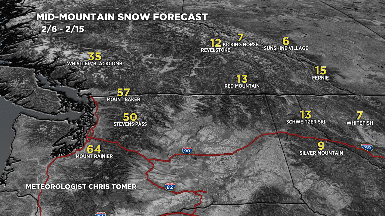
Forecast snow totals (inches) valid 2/6-2/15.
The key dates for snowfall are 2/6, 2/8-2/9, 2/12, 2/15.

Forecast snow totals (inches) valid 2/6-2/15.

Forecast snow totals (inches) valid 2/6-2/15.
