Tomer’s Take:
- Snow is likely 10/26 across the PNW, BC, ID, MT, WY, UT, and CO.
- Snow continues on 10/27 in CO and NM.
- Then high pressure rebuilds 10/28-10/31.
- A large trough moves back into the West 11/1-11/5. This would mean snow and colder weather for the ski areas.
- My NOV-DEC-JAN forecast is below.
Current Setup
Water vapor satellite shows the active storm track and low pressure systems lined-up. Orange/red = drier air aloft.

11/1-11/5
Looking down the road, the start of November looks active across the West. Below, forecast mid-atmosphere pressure anomalies valid 11/3/2022.

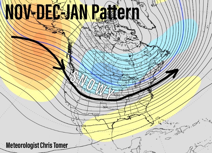
NOV-DEC-JAN Pattern
My forecast is active for the PNW, BC, Banff, MT, ID, WY, UT, and CO for NOV-DEC-JAN. This is in-line with my winter forecast.

Forecast Timing
Forecast radar/satellite through Halloween.
Forecast Snowfall
Forecast snow totals (inches) between 10/26-10/27.

Forecast snow totals (inches) between 11/1-11/4.

My forecast video:
Good to see higher totals for winter park!!
Very excited to see how this large trough pans out for the first week of November. Even more interested to see if a high moves back in for a similar slow start to last year after all this early-season tease…