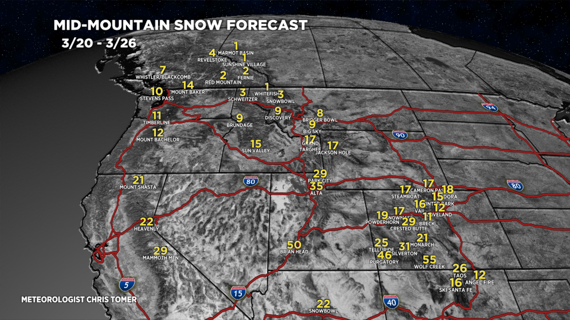
Tomer’s Take: 2-3 different storm systems are possible through 3/26 across the West. The snow bullseyes are CA, UT, AZ, NM, and CO with feet of accumulation.
Current Setup
Water vapor satellite shows the next storm cycle loading-up over the Pacific.

Forecast Tahoe Rain/Snow Line
3/19: 7400′
3/20: 5700′
3/21: 5600′
3/22: 5900′
Forecast Pattern
Forecast jet stream valid 3/25. Notice the big trough over the West keeping the pattern unsettled for the Mountains.

Forecast Timing
Forecast radar/satellite valid 3/17-3/22.
Wolf Creek, CO
3/17: 2″
3/18: 1″
3/20: Late 6-8″
3/21: 18″
3/22: 18″
3/23: 1″
3/25: 6″
3/26: 6″
Taos, NM
3/17: 3″
3/18: 1″
3/20: Late 4″
3/21: 12″
3/22: 12″
3/25: 2″
3/26: 2″
Forecast Totals
3/17-3/19:

3/20-3/26:

3/17-3/26:
VT/NH/ME bulk of snow occurs 3/23-3/25.

Thank you so much for providing this blog Chris. The accurate forecasting that you provide is crucial to planning and executing outdoor activities in Colorado and beyond. I was wondering if you could add Cuchara to your forecasting map.
https://www.cucharamountainpark.org/
Thanks again, Tim
Thanks, Tim…I’ll put Cuchara on my list. Chris