Tomer’s Take: The current atmospheric river (AR) continues through 3/11 then fades. The 2nd moderate to strong intensity AR surge occurs 3/13-3/15. Beyond 3/15 there is one additional storm systems but it’s not AR related.
Current Setup
Water vapor satellite shows the Pineapple Express.

Tahoe Rain/Snow Line
3/10: Up to 7,400′
3/11: Up to 6,900′
3/12: Up to 7,100′
3/13: Up to 7,100′
3/14: Up to 7,900′
3/15: Up to 6,800′
Forecast Pattern
Forecast jet stream valid 3/19. An area of low pressure is sliding across the Intermountain West.

Forecast AR
Below is the ECMWF Integrated Vapor Transport (IVT) for the next 7-10 days.

Forecast Timing
Forecast radar/satellite 3/10-3/15.
Forecast Totals
3/10-3/12:

3/13-3/19:

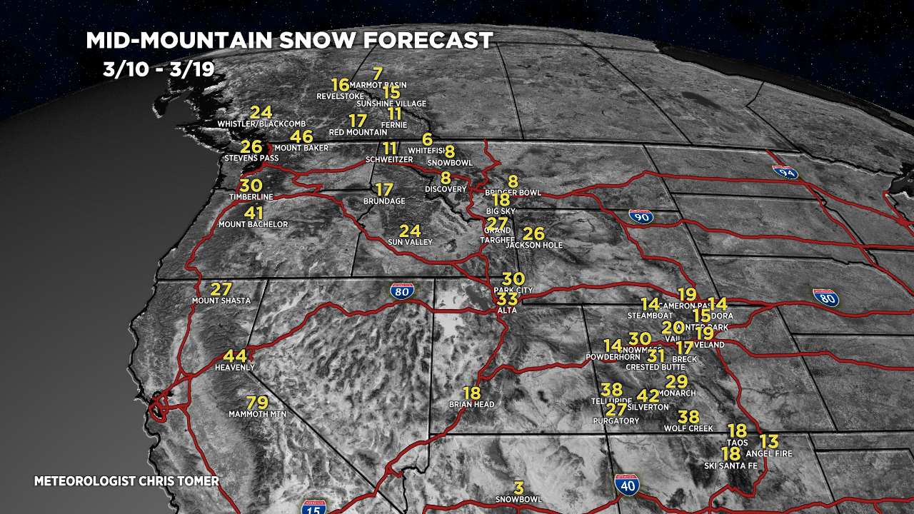
3/10-3/19 Grand Totals:

3/10-3/19 Grand Totals:

3/10-3/19:
VT/NH/ME Key Snow Dates:
3/13: Late 1″
3/14: 9″
3/15: 1″
3/19: 7″
