Tomer’s Take: 2-3 storm systems are lined-up for the West through 2/17. But, the largest and coldest storm system occurs 2/13-2/15.
Season Totals so far!

Current Setup
Infrared satellite shows a busy north Pacific. The initial trajectory of all storm systems is the PNW/BC where the biggest grand totals occur.

Forecast Pattern
Forecast jet stream valid 2/17. The main storm system of the group slides through 2/13-2/15. Another storm system is approaching the West Coast on 2/17.

Forecast Timing
Forecast radar/satellite valid 2/8-2/13.
Forecast Totals
Forecast snow totals (inches) valid 2/8-2/10.
CO snow timing: 2/8-2/9, 2/14-2/15.

Forecast snow totals (inches) valid 2/11-2/17.
UT snow timing: 2/14-2/15.
WY snow timing: 2/14.
NM snow timing: 2/9 and 2/15.

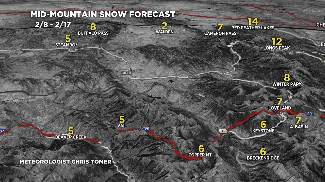
Forecast snow totals (inches) valid 2/8-2/17.

Forecast snow totals (inches) valid 2/8-2/17.

Forecast snow totals (inches) valid 2/8-2/17.
