Tomer’s Take: A few different areas of low pressure are lined-up in the Pacific with an initial trajectory into the PNW/BC on 2/3 then the storm track starts shifting further south on/after 2/5 through 2/12 to include CA, ID, UT, WY, MT, CO. Overall, forecast numbers have decreased a notch across the board.
My forecast video 2/3:
Current Setup
Water vapor satellite shows three different storm systems lined-up in the Pacific. The initial trajectory is the PNW/BC.

Forecast Pattern
Forecast jet stream valid 2/12. Notice the deep trough carrying a storm system into the West Coast.

Forecast Timing
Forecast radar/satellite valid 2/3-2/8.
Forecast Totals
Forecast snow totals (inches) valid 2/3-2/5.
99% of the snow in CO occurs late 2/5 into 2/6.
99% of the snow in the Wasatch occurs afternoon 2/5 into 2/6.

Forecast snow totals (inches) valid 2/6-2/12.

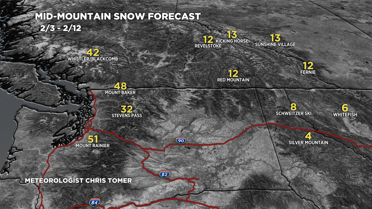
Forecast snow totals (inches) valid 2/3-2/12.
Totals are not as big as yesterday.
Mount Baker Timing:
2/3: 11″
2/4: 6″
2/5: 6″
2/6: 6″
2/7: 18″
2/8: 1″

Forecast snow totals (inches) valid 2/3-2/12.
