Tomer’s Take:
- Next storm system hits the West 11/1-11/6 and could include California. (Until then the PNW/BC/Banff are the bullseyes for best snow).
- Questions loom: How far south and west will this trough dig? Will upper-level winds be suitable for orographic snowfall? This will determine how much snow CA’s Sierra receive.
- And will this turn into a major southern track low for the southern Rockies?
Current Setup
Visible satellite shows the current storm track and low pressure systems lined-up in the north Pacific. The west will have to endure a few days of solid high pressure.

11/1-11/6
Data suggest a large trough of low pressure across the West. I’m not sold on blockbuster snow totals for CA yet. Will it squarely hit California? Will the wind direction be suitable for orographic snowfall? Will this become a strong southern track low?

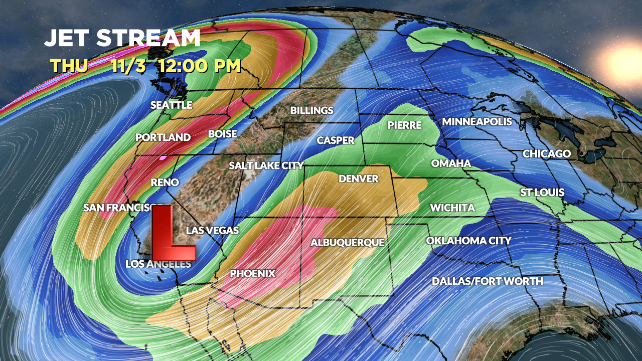
Forecast jet stream position is amplified and impressive on 11/3. This position would generate very strong mountain-top wind. But, will this be suitable for orographic snowfall?

Forecast Timing
Forecast radar/satellite valid 10/29-11/1.
Forecast Snowfall
Forecast snow totals (inches) valid 10/28-10/31.

Forecast snow totals (inches) valid 11/1-11/6.

My forecast video 10/28:

Looks like the base will be built. Last two la Nina’s the snow came too early and melted off. Also seams like this early season south CO gonna do better then Steamboat area, which runs contrary to the La Niña narrative. I remember WC got slammed 2 yrs ago and CB last year. Don’t recall steamboat ever getting hammered last few seasons… Doesn’t look like Cali is going to get hammered unless your name is Pelosi!
Thanks, Randall! Last couple years there’s a small window where Southern CO does well then the pattern changes flips back to more of a La Nina flow. I’m curious if that’s we’re seeing occur 11/1-11/6. As for CA, this trough might race through. But, I will say the pattern for mid to late NOV might still favor CA for another chance. Chris