Tomer’s Take: The atmospheric river (AR) runs through 1/16 then fades to zero. I’m forecasting big snow totals in CA, PNW, BC, parts of ID, parts of MT, WY, UT, and the Western Slope of CO.
My forecast video 1/8:
Current Setup
Water vapor satellite shows the Pineapple Express flow and remaining areas of low pressure.

Atmospheric River
Below is the ECMWF IVT forecast by latitude. Another two surges are lined-up through 1/16. Then the moisture fades and the jet configuration changes.

Forecast Pattern
Forecast jet stream valid 1/17. It’s a different jet configuration versus the last 10-15 days. The jet is split.

Forecast Timing
Forecast radar/satellite valid 1/8-1/13.
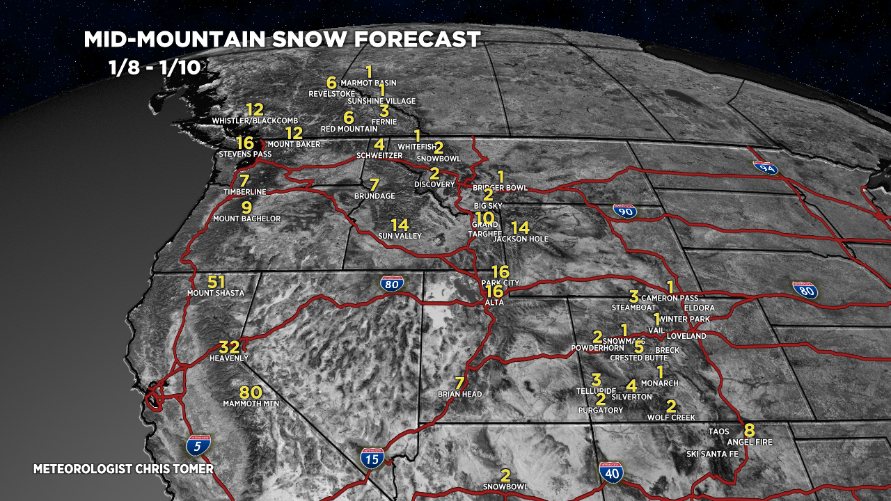
Forecast Totals
Forecast snow totals (inches) valid 1/8-1/10.

Forecast snow totals (inches) valid 1/11-1/17.

Forecast snow totals (inches) valid 1/8-1/17.

Hey Tomer, thanks for the weather updates. You were why I use to watch daybreak when I lived in Denver. I recently moved to Pagosa and the weather forecasting is much more difficult down here so your forecasts have helped a ton. If you ever want to come to Pagosa and Ski Wolf Creek or do some mountaineering we have a rental you are welcome to stay in!
Thanks so much, Matt! Appreciate the invitation. Chris