Tomer’s Take: Freezing levels will rise quickly and stay high through 5/23. And, there’s a lot of snowpack remaining. Plus, the pattern remains wetter than normal on 5/14, 5/15, and 5/18 with rain showers/thunderstorms likely even at mid/high elevations.
Forecast Freezing Level
Wasatch Mountains, UT, Daily Max/Min:
5/14: 12800’/11800′
5/15: 13600’/12600′
5/16: 13800’/13600′
5/17: 13600’/13100′
5/18: 13800’/13000′
Colorado’s Central Mountain Zone, Daily Max/Min:
5/14: 12000’/10700′
5/15: 13600’/11500′
5/16: 14300’/12300′
5/17: 14400’/12800′
5/18: 14600’/12000′
Teton Range, WY:
5/14: 11800/10200′
5/15: 12800’/12800′
5/16: 12800/12000′
5/17: 13000’/12000′
5/18: 12300’/11200′
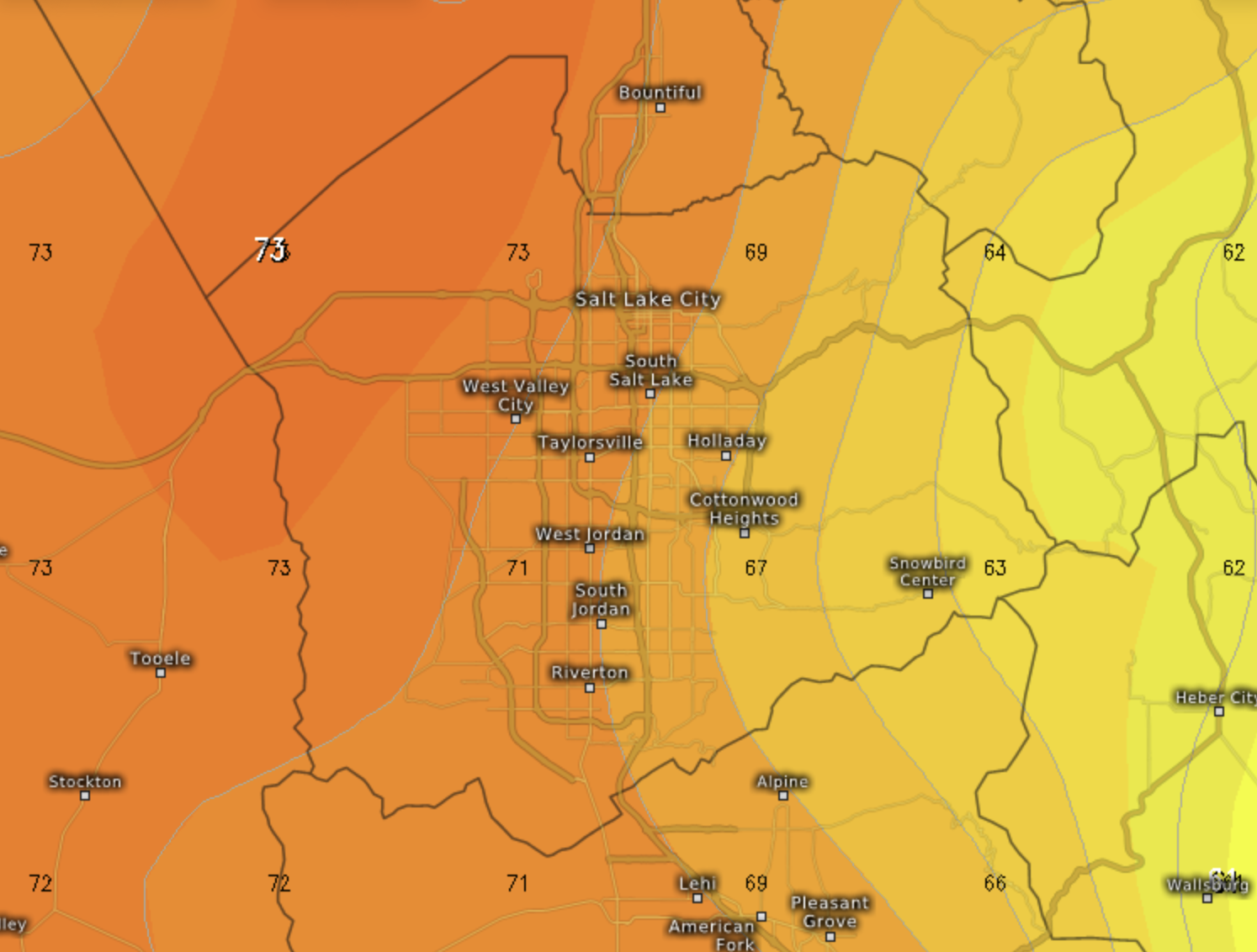
Max Air Temps 5/16, 1pm
Max air temps reach the 60-70F range at Snowbird/Alta, Wasatch Mountains, UT:

Max air temps reach the 50-55F range across the Teton Range, WY:

Current Snowpack
Utah Snow-Water-Equivalent (SWE) Percentage of Median:

Colorado Snow-Water-Equivalent (SWE) Percentage of Median:

Rich Moisture Flow 5/14, 5/15, and 5/18
Forecast precipitable water % of normal valid 5/18, Monsoon-esque:

Forecast Pattern
Forecast jet stream valid 5/23. Most of the West is under the influence of a high pressure ridge. This accelerates the snowmelt.

Forecast Timing
Forecast radar/satellite valid 5/14-5/19:
Forecast Snow Totals
High freezing levels equates to very little snow.

https://www.instagram.com/reel/CsH-qyjrOAB/?igshid=MzRlODBiNWFlZA==
Is this real Chris ?
Yes, that’s legit, Brian!