Tomer’s Take: Heavy snow continues through 3/3 for the West with a powerful jet conveyor belt. A few deep snow accumulation bullseyes continue. The Sierra could see 50-100 inches by 3/3.
Alta, UT is reporting 20″ in 24 hours with more to come!
Jackson Hole, WY is reporting 12″ in 24 hours. This officially puts them over 400″ for the season so far!
Current Setup
Water vapor satellite shows a big trough of low pressure across the West. This sets the stage for additional areas of low pressure to hit the same areas through 3/3.

Forecast Pattern
Forecast jet stream valid 3/1. A large trough and strong storm systems is sliding through CA with heavy snow accumulation.

Forecast Timing
Forecast radar/satellite valid 2/22-2/27.
Alta, UT
2/22: 7″
2/23: 4″
2/24: 1″
2/26: 5″
2/27: 5″
2/28: 7″
3/1: 7″
3/2: 7″
Telluride, CO
2/22: 12″
2/23: 8″
2/24: 1″
2/26: 5″
3/2: 4″
3/3: 1″
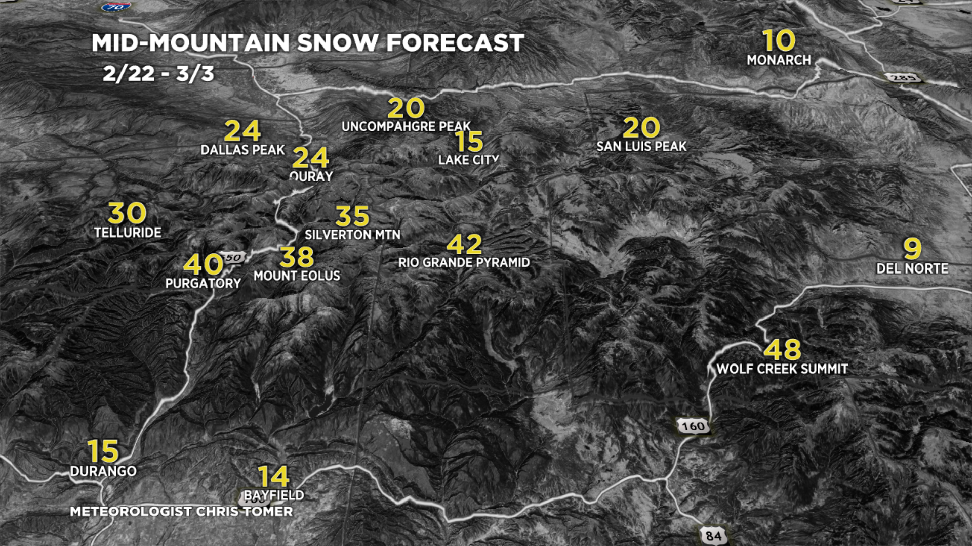
Forecast Totals
2/22-2/24:

2/25-3/3:

2/22-3/3:

2/22-3/3:

2/22-3/3:

2/22-3/3:
VT/NH/ME Key Snow Dates:
2/22: Late 3″
2/23: 10″
2/24: 1″
2/25: 1″
2/26: 1″
2/27: Late 3″
2/28: 10″
3/3: 1″


What happens to Idaho during these storms? We seem to always get a miss… 🙁