Tomer’s Take: A snow bullseye is setting up for the PNW/BC between 2/3-2/9 with feet of accumulation. Blow-off from this rich flow and a storm system also benefits ID, MT, WY, UT, CO, and CA on/after 2/5.
Season Totals

Current Setup
Water vapor satellite shows a split jet flow running around a high pressure over CA. This directs a rich flow into the PNW/BC.

Forecast Pattern
Forecast jet stream valid 2/10. A trough approaches the West Coast with high pressure ridging over the interior Rockies.

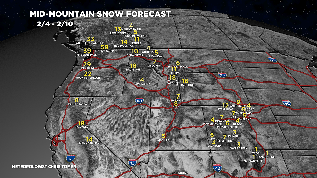
Forecast Totals
Forecast snow totals (inches) valid 2/1-2/3. Snow starts hitting PNW/BC afternoon of 2/3.

Forecast snow totals (inches) valid 2/4-2/10. The bulk of snow hits on/after 2/5 in ID, WY, MT, CO, UT, CA.

Forecast snow totals (inches) valid 2/1-2/10.

Love the content! How long will the high-pressure stay around for over the interior rockies ~2/10? Does it look like some storms will follow?
Hi Thomas,
Interior Rockies see snow 2/5-2/6 then some ridging weakens a storm system on 2/9-2/10. Beyond that is a storm system 2/13-2/14. So…there are some dry gaps in the flow and the 2/9-2/10 storm is trending much weaker.
Chris