Tomer’s Take: I’m forecasting 1-2 additional storm systems for the West through 3/11. The pattern 3/11 through 3/16 is less active but might have lingering snow for parts of WY, MT, UT, and CO. The Northeast gets heavy snow on 3/4.
Season Totals so far:
The race to 600″ is on!

Current Setup
Water vapor satellite shows the ABQ low sliding east and two additional areas of low pressure lined-up over the Pacific.

Forecast Pattern
Forecast jet stream 3/9. Notice the deep trough swinging through the Intermountain West.

Forecast Pattern Mid March
Forecast mid-atmospheric pressure anomalies on 3/16 favor unsettled weather for MT, WY, UT, CO and most of the Northeast.

Sun Valley, ID
3/3: 1″
3/4: 2″
3/5: 3″
3/6: 1″
3/7: 1″
Killington, VT
3/2: 1″
3/3: Late 1″
3/4: 10″
3/5: 1″
3/7: 2″
3/11: 2″
Steamboat, CO
3/3: 4″
3/5: 6-8″
3/6: 6″
3/7: 2″
3/8: 2″
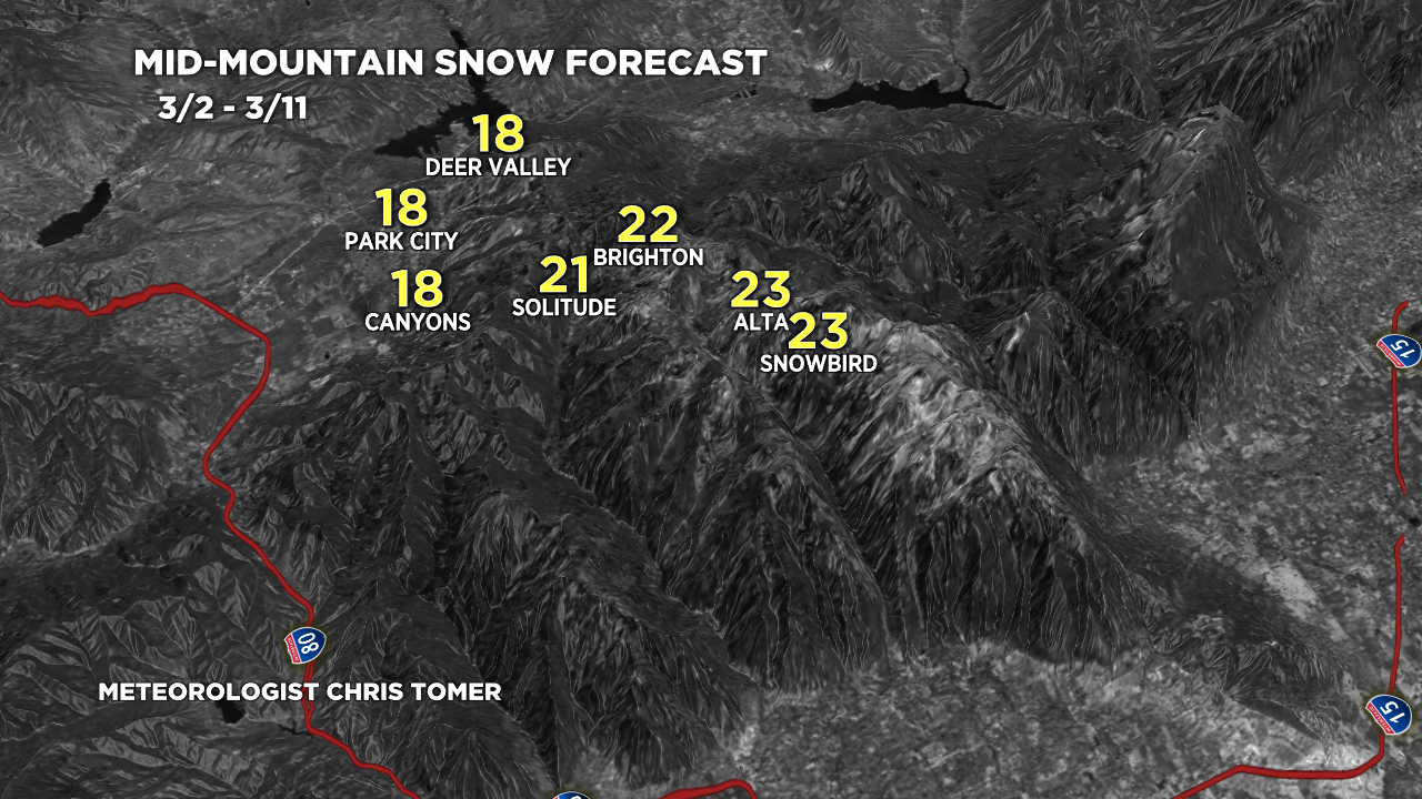
Forecast Totals
3/2-3/4:

3/5-3/11:

3/2-3/11:

3/2-3/11:

3/2-3/11:
